
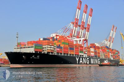
YM TRILLION
Cargo
Current Trip
| Time Travelled | 12 days |
|---|---|
| Remaining Time | --- |
| Distance Travelled | 4517.64 nm |
| Remaining Distance | 177.20 nm |
| AVG Speed | 15.1 Knots |
| MAX Speed | 21.2 Knots |
| AVG Wind | 17.3 knots |
| MAX Wind | 36.8 knots |
| MIN Temp | 2.6°C / 36.68°F |
| MAX Temp | 18.7°C / 65.66°F |
| Draught | 15.2 m |
| Position Received | 1 m ago |
Current Position
| Longitude | -125.57116° |
|---|---|
| Latitude | 48.52799° |
| Status | Under way using engine |
| Speed | 2.3 Knots |
| Course | 16° |
| Area | North Pacific Ocean |
| Station | T-AIS |
| Position Received | 1 m ago |
Info
Information
The current position of YM TRILLION is in North Pacific Ocean with coordinates 48.52799° / -125.57116° as reported on 2024-06-06 21:55 by AIS to our vessel tracker app. The vessel's current speed is 2.3 Knots and is heading at the port of TACOMA. The estimated time of arrival as calculated by vessel tracking app is 2024-06-07 06:30 LT
The vessel YM TRILLION (IMO: 9792709, MMSI: 636022027) is a Cargo It's sailing under the flag of [LR] Liberia.
In this page you can find informations about the vessels current position, last detected port calls, and current voyage information. If the vessels is not in coverage by AIS you will find the latest position.
The current position of YM TRILLION is detected by our AIS receivers and we are not responsible for the reliability of the data. The last position was recorded while the vessel was in Coverage by the Ais receivers of our vessel tracking app.
The current draught of YM TRILLION as reported by AIS is 15.2 meters
Weather
| Temperature | 11.1°C / 51.98°F |
|---|---|
| Wind Speed | 17 knots |
| Direction | 309° NW |
| Pressure | 1021.6 hPa |
| Humidity | 84.1 % |
| Cloud Coverage | 18 % |
Featured Company
Last Port Calls
| Port | Arrival | Departure | Time In Port |
|---|---|---|---|
| 2024-05-24 12:00 | 2024-05-25 14:32 | 1 d | |
| 2024-05-15 14:27 | 2024-05-16 09:40 | 19 h | |
| 2024-05-09 10:37 | 2024-05-10 07:41 | 21 h | |
| 2024-05-05 06:12 | 2024-05-06 03:44 | 21 h | |
| 2024-05-02 12:51 | 2024-05-03 09:20 | 20 h | |
| 2024-04-30 12:32 | 2024-05-01 15:59 | 1 d | |
| 2024-04-14 21:03 | 2024-04-18 16:50 | 3 d | |
| 2024-04-03 16:02 | 2024-04-09 14:27 | 5 d | |
| 2024-04-01 09:29 |
Most Visited Ports (Last year)
| Port | Arrivals | |
|---|---|---|
| 10 | ||
| 6 | ||
| 5 | ||
| 4 | ||
| 4 | ||
| 3 |
Last Trips
| Origin | Departure | Destination | Arrival | Distance | |
|---|---|---|---|---|---|
| 2024-05-16 17:40 | 2024-05-24 21:00 | 1368.89 nm | |||
| 2024-05-10 15:41 | 2024-05-15 22:27 | 1363.54 nm | |||
| 2024-05-06 11:44 | 2024-05-09 18:37 | 1209.14 nm | |||
| 2024-05-03 18:20 | 2024-05-05 14:12 | 478.70 nm | |||
| 2024-05-02 00:59 | 2024-05-02 21:51 | 103.41 nm | |||
| 2024-04-18 09:50 | 2024-04-30 21:32 | 4712.26 nm | |||
| 2024-04-09 07:27 | 2024-04-14 14:03 | 185.24 nm | |||
| 2024-04-01 02:29 | 2024-04-03 09:02 | 662.78 nm |
Events
| Time | Event | Details | Position / Dest | Info |
|---|---|---|---|---|
| 2024-06-06 20:18 | ETA Changed | 2024/06/07 06:30 2024/06/07 06:00 |
48.66105 / -125.99709
USTIW
|
Speed: 15.1 kn Course: 115.2° |
| 2024-06-06 16:22 | Draught Changed | 15.2 15 |
49.09336 / -127.42270
USTIW
|
Speed: 16.4 kn Course: 113.9° |
| 2024-06-06 15:08 | Change Sea Area | Canadian part of the North Pacific Ocean Japanese part of the North Pacific Ocean |
49.22941 / -127.89069
North Pacific Ocean
USTIW
|
Speed: 16 kn Course: 112.9° |
| 2024-06-06 15:07 | IN Coverage |
49.22941 / -127.89069
North Pacific Ocean
USTIW
|
Speed: 16 kn Course: 112.9° |