
YSALINE
Cargo
Current Trip
| Time Travelled | 1 day |
|---|---|
| Remaining Time | 4 mins |
| Distance Travelled | 642.80 nm |
| Remaining Distance | 6.36 nm |
| AVG Speed | 15.9 Knots |
| MAX Speed | 19.5 Knots |
| AVG Wind | 15.8 knots |
| MAX Wind | 24.7 knots |
| MIN Temp | 7.8°C / 46.04°F |
| MAX Temp | 14.4°C / 57.92°F |
| Draught | 6.7 m |
| Position Received | Now |
Current Position
| Longitude | 4.07115° |
|---|---|
| Latitude | 51.98026° |
| Status | Under way using engine |
| Speed | 13.2 Knots |
| Course | 115.8° |
| Area | North Sea |
| Station | T-AIS |
| Position Received | Now |
Info
Information
The current position of YSALINE is in North Sea with coordinates 51.98026° / 4.07115° as reported on 2024-06-10 12:27 by AIS to our vessel tracker app. The vessel's current speed is 13.2 Knots and is heading at the port of ROTTERDAM. The estimated time of arrival as calculated by vessel tracking app is 2024-06-10 12:32 LT
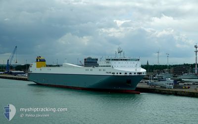
The vessel YSALINE (IMO: 9823364, MMSI: 248744000) is a Cargo It's sailing under the flag of [MT] Malta.
In this page you can find informations about the vessels current position, last detected port calls, and current voyage information. If the vessels is not in coverage by AIS you will find the latest position.
The current position of YSALINE is detected by our AIS receivers and we are not responsible for the reliability of the data. The last position was recorded while the vessel was in Coverage by the Ais receivers of our vessel tracking app.
The current draught of YSALINE as reported by AIS is 6.7 meters
Weather
| Temperature | 12.7°C / 54.86°F |
|---|---|
| Wind Speed | 15 knots |
| Direction | 242° WSW |
| Pressure | 1002 hPa |
| Humidity | 77 % |
| Cloud Coverage | 99 % |
Featured Company
Last Port Calls
| Port | Arrival | Departure | Time In Port |
|---|---|---|---|
| 2024-06-08 10:29 | 2024-06-08 21:18 | 10 h | |
| 2024-06-06 04:49 | 2024-06-06 18:40 | 13 h | |
| 2024-06-03 08:08 | 2024-06-04 12:31 | 1 d | |
| 2024-06-01 04:40 | 2024-06-01 17:25 | 12 h | |
| 2024-06-01 03:24 | 2024-06-01 04:22 | 57 m | |
| 2024-05-30 03:01 | 2024-05-30 13:27 | 10 h | |
| 2024-05-27 13:36 | 2024-05-28 12:44 | 23 h | |
| 2024-05-27 12:21 | 2024-05-27 13:20 | 58 m | |
| 2024-05-25 10:26 | 2024-05-25 20:57 | 10 h | |
| 2024-05-22 15:20 | 2024-05-23 19:05 | 1 d |
Last Trips
| Origin | Departure | Destination | Arrival | Distance | |
|---|---|---|---|---|---|
| 2024-06-06 20:40 | 2024-06-08 11:29 | 635.86 nm | |||
| 2024-06-04 13:31 | 2024-06-06 06:49 | 649.76 nm | |||
| 2024-06-01 19:25 | 2024-06-03 09:08 | 636.48 nm | |||
| 2024-06-01 06:22 | 2024-06-01 06:40 | 0.64 nm | |||
| 2024-05-30 14:27 | 2024-06-01 05:24 | 641.17 nm | |||
| 2024-05-28 14:44 | 2024-05-30 04:01 | 634.19 nm | |||
| 2024-05-27 15:20 | 2024-05-27 15:36 | 0.70 nm | |||
| 2024-05-25 21:57 | 2024-05-27 14:21 | 643.84 nm | |||
| 2024-05-23 21:05 | 2024-05-25 11:26 | 634.62 nm | |||
| 2024-05-22 17:06 | 2024-05-22 17:20 | 0.51 nm |
Events
| Time | Event | Details | Position / Dest | Info |
|---|---|---|---|---|
| 2024-06-10 08:56 | Change Sea Area | Dutch part of the North Sea Belgian part of the North Sea |
51.77288 / 2.73087
North Sea
NLRTM
|
Speed: 15.2 kn Course: 67.8° |
| 2024-06-10 07:23 | Change Sea Area | Belgian part of the North Sea French part of the North Sea |
51.52103 / 2.26261
North Sea
NLRTM
|
Speed: 14.8 kn Course: 39.2° |
| 2024-06-10 04:47 | Change Sea Area | French part of the North Sea French part of the English Channel |
51.00199 / 1.61571
North Sea
NLRTM
|
Speed: 16.2 kn Course: 42.5° |
| 2024-06-10 02:56 | Change Sea Area | French part of the English Channel United Kingdom part of the English Channel |
50.58293 / 1.17489
English Channel
NLRTM
|
Speed: 16.9 kn Course: 47.9° |
| 2024-06-10 02:56 | Status Changed | Under way using engine Default |
50.58293 / 1.17489
NLRTM
|
Speed: 16.9 kn Course: 48° |
| 2024-06-10 02:51 | IN Coverage |
50.58293 / 1.17489
English Channel
NLRTM
|
Speed: 16.9 kn Course: 47.9° |
|
| 2024-06-10 01:57 | Status Changed | Default Under way using engine |
50.44964 / .81491
NLRTM
|
Speed: 16.3 kn Course: 70.9° |
| 2024-06-10 01:50 | Status Changed | Under way using engine Default |
50.43861 / .76234
NLRTM
|
Speed: 16.3 kn Course: 71° |
| 2024-06-10 01:50 | OUT of Coverage |
50.43861 / .76234
English Channel
NLRTM
|
Speed: 16.3 kn Course: 70.9° |
|
| 2024-06-10 01:45 | Status Changed | Default Under way using engine |
50.43183 / .73128
NLRTM
|
Speed: 16.4 kn Course: 71.4° |