
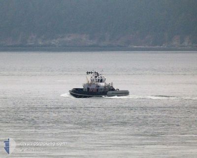
YT813 SENTINEL
Tug
Current Trip
| Time Travelled | 15 days |
|---|---|
| Remaining Time | --- |
| Distance Travelled | 107.72 nm |
| Remaining Distance | --- |
| AVG Speed | 11.1 Knots |
| MAX Speed | 16.1 Knots |
| AVG Wind | 8.9 knots |
| MAX Wind | 16.3 knots |
| MIN Temp | 8.9°C / 48.02°F |
| MAX Temp | 19.4°C / 66.92°F |
| Draught | 5 m |
| Position Received | 2 d ago |
Current Position
| Longitude | -122.64685° |
|---|---|
| Latitude | 47.55483° |
| Status | Moored |
| Speed | 0.1 Knots |
| Course | --- |
| Area | The Coastal Waters of Southeast Alaska and British Columbia |
| Station | T-AIS |
| Position Received | 2 d ago |
Info
Information
The current position of YT813 SENTINEL is in The Coastal Waters of Southeast Alaska and British Columbia with coordinates 47.55483° / -122.64685° as reported on 2024-06-13 17:49 by AIS to our vessel tracker app. The vessel's current speed is 0.1 Knots
The vessel YT813 SENTINEL (MMSI: 368926641) is a Tug It's sailing under the flag of [US] USA.
In this page you can find informations about the vessels current position, last detected port calls, and current voyage information. If the vessels is not in coverage by AIS you will find the latest position.
The current position of YT813 SENTINEL is detected by our AIS receivers and we are not responsible for the reliability of the data. The last position was recorded while the vessel was in Coverage by the Ais receivers of our vessel tracking app.
The current draught of YT813 SENTINEL as reported by AIS is 5 meters
Weather
| Temperature | 17.2°C / 62.96°F |
|---|---|
| Wind Speed | 3 knots |
| Direction | 30° NNE |
| Pressure | 1018.8 hPa |
| Humidity | 47.4 % |
| Cloud Coverage | 29 % |
Featured Company
Last Port Calls
| Port | Arrival | Departure | Time In Port |
|---|---|---|---|
| 2024-05-31 18:37 | 2024-05-31 19:01 | 23 m | |
| 2024-05-31 17:38 | 2024-05-31 17:40 | 2 m | |
| 2024-05-29 19:39 | 2024-05-29 19:58 | 18 m | |
| 2024-05-23 13:21 | 2024-05-23 15:44 | 2 h | |
| 2024-05-16 20:40 | 2024-05-16 21:21 | 41 m | |
| 2024-05-16 19:00 | 2024-05-16 20:12 | 1 h | |
| 2024-05-14 17:09 | 2024-05-14 17:29 | 20 m | |
| 2024-05-14 16:34 | 2024-05-14 16:38 | 4 m | |
| 2024-05-14 15:19 | 2024-05-14 15:24 | 4 m | |
| 2024-05-14 13:45 | 2024-05-14 15:11 | 1 h |
Most Visited Ports (Last year)
| Port | Arrivals | |
|---|---|---|
| 24 | ||
| 14 | ||
| 13 | ||
| 2 | ||
| 2 |
Last Trips
| Origin | Departure | Destination | Arrival | Distance | |
|---|---|---|---|---|---|
| 2024-05-31 10:40 | 2024-05-31 11:37 | 1.93 nm | |||
| 2024-05-29 12:58 | 2024-05-31 10:38 | 2.27 nm | |||
| 2024-05-23 08:44 | 2024-05-29 12:39 | 93.02 nm | |||
| 2024-05-16 14:21 | 2024-05-23 06:21 | 69.72 nm | |||
| 2024-05-16 13:12 | 2024-05-16 13:40 | 2.99 nm | |||
| 2024-05-14 10:29 | 2024-05-16 12:00 | 35.25 nm | |||
| 2024-05-14 09:38 | 2024-05-14 10:09 | 0.34 nm | |||
| 2024-05-14 08:24 | 2024-05-14 09:34 | 8.37 nm | |||
| 2024-05-14 08:11 | 2024-05-14 08:19 | 1.19 nm | |||
| 2024-05-07 14:57 | 2024-05-14 06:45 | 14.36 nm |
Events
| Time | Event | Details | Position / Dest | Info |
|---|---|---|---|---|
| 2024-06-13 17:49 | OUT of Coverage |
47.55483 / -122.64685
The Coastal Waters of Southeast Alaska and British Columbia
|
Speed: 0.1 kn Course: 326.2° |
|
| 2024-06-13 17:48 | STOP Moving | 0.97 nm, West of BREMERTON |
47.55483 / -122.64682
BREMERTON
|
Speed: 0.1 kn Course: 3° |
| 2024-06-13 17:39 | START Moving | 0.57 nm, South West of BREMERTON |
47.55671 / -122.63746
BREMERTON
|
Speed: 3.5 kn Course: 40° |
| 2024-06-13 17:38 | Status Changed | Moored Default |
47.55680 / -122.63734
BREMERTON
|
Speed: Course: 294° |
| 2024-06-13 17:35 | Status Changed | Default Moored |
47.55681 / -122.63734
BREMERTON
|
Speed: 2.3 kn Course: 359° |
| 2024-06-13 17:20 | STOP Moving | 0.88 nm, South West of BREMERTON |
47.55114 / -122.64123
BREMERTON
|
Speed: 0.1 kn Course: 38° |
| 2024-06-13 17:18 | START Moving | 0.84 nm, South West of BREMERTON |
47.55245 / -122.64143
BREMERTON
|
Speed: 3.2 kn Course: 353° |
| 2024-06-13 17:16 | Status Changed | Moored Default |
47.55395 / -122.64166
BREMERTON
|
Speed: 1 kn Course: -1° |
| 2024-06-13 17:15 | Status Changed | Default Moored |
47.55333 / -122.64167
BREMERTON
|
Speed: Course: 0° |
| 2024-06-13 16:19 | Status Changed | Moored Default |
47.55513 / -122.64171
BREMERTON
|
Speed: Course: -1° |