
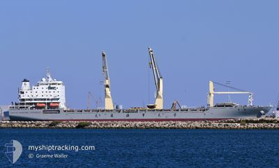
YU PENG
Cargo
Current Trip
| Time Travelled | 15 days |
|---|---|
| Remaining Time | --- |
| Distance Travelled | 4877.00 nm |
| Remaining Distance | --- |
| AVG Speed | 12.6 Knots |
| MAX Speed | 18 Knots |
| AVG Wind | 11.6 knots |
| MAX Wind | 22.9 knots |
| MIN Temp | 15.8°C / 60.44°F |
| MAX Temp | 30.5°C / 86.9°F |
| Draught | 8 m |
| Position Received | 1 m ago |
Current Position
| Longitude | 152.04683° |
|---|---|
| Latitude | -33.06217° |
| Status | Under way using engine |
| Speed | 0.9 Knots |
| Course | 102° |
| Area | Tasman Sea |
| Station | T-AIS |
| Position Received | 1 m ago |
Info
Information
The current position of YU PENG is in Tasman Sea with coordinates -33.06217° / 152.04683° as reported on 2024-05-23 08:17 by AIS to our vessel tracker app. The vessel's current speed is 0.9 Knots
The vessel YU PENG (IMO: 9723473, MMSI: 412212110) is a Cargo It's sailing under the flag of [CN] China.
In this page you can find informations about the vessels current position, last detected port calls, and current voyage information. If the vessels is not in coverage by AIS you will find the latest position.
The current position of YU PENG is detected by our AIS receivers and we are not responsible for the reliability of the data. The last position was recorded while the vessel was in Coverage by the Ais receivers of our vessel tracking app.
The current draught of YU PENG as reported by AIS is 8 meters
Weather
| Temperature | 17.8°C / 64.04°F |
|---|---|
| Wind Speed | 9 knots |
| Direction | 191° S |
| Pressure | 1025.1 hPa |
| Humidity | 69.6 % |
| Cloud Coverage | 8 % |
Featured Company
Last Port Calls
| Port | Arrival | Departure | Time In Port |
|---|---|---|---|
| 2024-05-06 00:08 | 2024-05-08 03:24 | 2 d | |
| 2024-04-24 04:00 | 2024-04-25 01:31 | 21 h | |
| 2024-04-15 13:13 | 2024-04-20 11:57 | 4 d | |
| 2024-03-21 15:52 | 2024-03-22 13:54 | 22 h | |
| 2024-03-19 10:37 | |||
| 2024-03-09 22:07 | 2024-03-10 14:31 | 16 h |
Last Trips
| Origin | Departure | Destination | Arrival | Distance | |
|---|---|---|---|---|---|
| 2024-04-25 09:31 | 2024-05-06 07:08 | 3625.61 nm | |||
| 2024-04-20 19:57 | 2024-04-24 12:00 | 1018.10 nm | |||
| 2024-03-22 21:54 | 2024-04-15 21:13 | 2881.32 nm | |||
| 2024-03-19 18:37 | 2024-03-21 23:52 | 652.56 nm | |||
| 2024-02-12 10:09 | 2024-03-10 06:07 | 4557.16 nm |
Events
| Time | Event | Details | Position / Dest | Info |
|---|---|---|---|---|
| 2024-05-23 07:11 | Status Changed | Under way using engine Default |
-33.05567 / 152.04883
AU NTL
|
Speed: 1.5 kn Course: 104° |
| 2024-05-23 07:08 | Status Changed | Default Under way using engine |
-33.05600 / 152.04883
AU NTL
|
Speed: 0.4 kn Course: 102° |
| 2024-05-22 22:07 | STOP Moving | 16.97 nm, South East of NEWCASTLE |
-33.10118 / 151.99661
AU NTL
|
Speed: 0.2 kn Course: 165° |
| 2024-05-22 20:02 | START Moving | 14.1 nm, South of PORT STEPHENS |
-32.95017 / 152.06549
AU NTL
|
Speed: 3.3 kn Course: 136° |
| 2024-05-22 18:39 | STOP Moving | 14.96 nm, East of NEWCASTLE |
-32.96910 / 152.04568
AU NTL
|
Speed: 0.3 kn Course: 106° |
| 2024-05-22 18:37 | START Moving | 14.95 nm, East of NEWCASTLE |
-32.96977 / 152.04541
AU NTL
|
Speed: 3.4 kn Course: 104° |
| 2024-05-22 13:34 | STOP Moving | 14.78 nm, South East of NEWCASTLE |
-33.03813 / 152.00315
AU NTL
|
Speed: 0.3 kn Course: 193° |
| 2024-05-22 08:12 | Draught Changed | 8 7.2 |
-32.41529 / 152.73489
AU NTL
|
Speed: 13 kn Course: 208° |
| 2024-05-22 08:12 | ETA Changed | 2024/05/22 12:00 2024/05/21 18:00 |
-32.41529 / 152.73489
AU NTL
|
Speed: 13 kn Course: 208° |
| 2024-05-22 08:07 | Change Sea Area | Australian part of the Tasman Sea Vietnamese part of the South China Sea |
-32.39819 / 152.74563
Tasman Sea
|
Speed: 12.7 kn Course: 208° |