
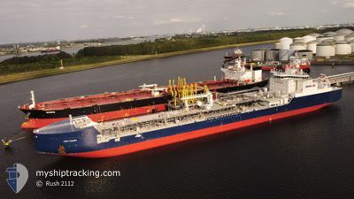
YURIY KUCHIEV
Tanker
Current Trip
FOR ORDERS
| Time Travelled | 3 days |
|---|---|
| Remaining Time | --- |
| Distance Travelled | 671.26 nm |
| Remaining Distance | --- |
| AVG Speed | 10.1 Knots |
| MAX Speed | 15.6 Knots |
| AVG Wind | 10.6 knots |
| MAX Wind | 17.4 knots |
| MIN Temp | -6.5°C / 20.3°F |
| MAX Temp | 0.4°C / 32.72°F |
| Draught | 9.3 m |
| Position Received | 12 d ago |
Current Position
| Longitude | 27.91352° |
|---|---|
| Latitude | 71.95368° |
| Status | Under way using engine |
| Speed | 13.6 Knots |
| Course | 58.5° |
| Area | Barentsz Sea |
| Station | T-AIS |
| Position Received | 12 d ago |
Info
Information
The current position of YURIY KUCHIEV is in Barentsz Sea with coordinates 71.95368° / 27.91352° as reported on 2024-05-19 20:14 by AIS to our vessel tracker app. The vessel's current speed is 13.6 Knots
The vessel YURIY KUCHIEV (IMO: 9804033, MMSI: 209508000) is a Tanker It's sailing under the flag of [CY] Cyprus.
In this page you can find informations about the vessels current position, last detected port calls, and current voyage information. If the vessels is not in coverage by AIS you will find the latest position.
The current position of YURIY KUCHIEV is detected by our AIS receivers and we are not responsible for the reliability of the data. The last position was recorded while the vessel was in Coverage by the Ais receivers of our vessel tracking app.
The current draught of YURIY KUCHIEV as reported by AIS is 9.3 meters
Weather
| Temperature | -0.2°C / 31.64°F |
|---|---|
| Wind Speed | 4 knots |
| Direction | 276° W |
| Pressure | 1020.7 hPa |
| Humidity | 74.1 % |
| Cloud Coverage | 100 % |
Featured Company
Last Trips
| Origin | Departure | Destination | Arrival | Distance | |
|---|---|---|---|---|---|
| 2024-05-13 15:49 | 2024-05-25 20:27 | 2640.28 nm | |||
| 2024-05-01 10:34 | 2024-05-11 13:26 | 2613.34 nm | |||
| 2024-04-16 13:21 | 2024-04-29 20:21 | 2723.87 nm | |||
| 2024-04-04 12:20 | 2024-04-14 17:10 | 2619.51 nm | |||
| 2024-03-24 10:46 | 2024-04-03 12:17 | 2582.02 nm |
Events
| Time | Event | Details | Position / Dest | Info |
|---|---|---|---|---|
| 2024-05-29 20:54 | START Moving |
73.48757 / 72.91447
FOR ORDERS
|
Speed: 4.3 kn Course: 10° |
|
| 2024-05-29 19:39 | STOP Moving |
73.48291 / 72.89515
FOR ORDERS
|
Speed: 0.3 kn Course: 8° |
|
| 2024-05-29 16:29 | START Moving |
73.22166 / 72.82500
FOR ORDERS
|
Speed: 9 kn Course: 22° |
|
| 2024-05-29 10:13 | STOP Moving |
73.14667 / 72.74333
FOR ORDERS
|
Speed: Course: -1° |
|
| 2024-05-29 04:23 | START Moving |
72.57667 / 73.78333
FOR ORDERS
|
Speed: 6 kn Course: 331° |
|
| 2024-05-29 04:11 | STOP Moving |
72.57000 / 73.80500
FOR ORDERS
|
Speed: Course: -1° |
|
| 2024-05-28 18:22 | START Moving | 1.15 nm, North East of SABETTA |
71.29102 / 72.12476
FOR ORDERS
|
Speed: 9.2 kn Course: 45° |
| 2024-05-28 18:15 | PORT DEPARTURE |
|
71.29102 / 72.12476
FOR ORDERS
|
Speed: 0.3 kn Course: 188° |
| 2024-05-25 15:27 | STOP Moving |
71.27500 / 72.09500
[RU] SABETTA
|
Speed: Course: -1° |
|
| 2024-05-25 15:27 | PORT ARRIVAL |
|
71.27500 / 72.09500
[RU] SABETTA
|
Speed: 0.6 kn Course: 200° |