
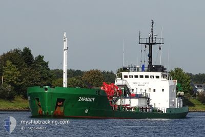
ZAPADNYY
Edible Oil Tanker
Current Trip
| Time Travelled | 1 day |
|---|---|
| Remaining Time | 1 day |
| Distance Travelled | 206.04 nm |
| Remaining Distance | 238.29 nm |
| AVG Speed | 7.5 Knots |
| MAX Speed | 8.5 Knots |
| AVG Wind | 10.8 knots |
| MAX Wind | 22.9 knots |
| MIN Temp | 12.8°C / 55.04°F |
| MAX Temp | 15.9°C / 60.62°F |
| Draught | 5.7 m |
| Position Received | 1 m ago |
Current Position
| Longitude | 15.09645° |
|---|---|
| Latitude | 55.56856° |
| Status | Under way using engine |
| Speed | 7.9 Knots |
| Course | 247.6° |
| Area | Kattegat |
| Station | T-AIS |
| Position Received | 1 m ago |
Info
Information
The current position of ZAPADNYY is in Kattegat with coordinates 55.56856° / 15.09645° as reported on 2024-06-16 01:09 by AIS to our vessel tracker app. The vessel's current speed is 7.9 Knots and is heading at the port of RANDERS. The estimated time of arrival as calculated by vessel tracking app is 2024-06-17 12:21 LT
The vessel ZAPADNYY (IMO: 8711837, MMSI: 312786000) is a Edible Oil Tanker that was built in 1988 ( 36 years old ). It's sailing under the flag of [BZ] Belize.
In this page you can find informations about the vessels current position, last detected port calls, and current voyage information. If the vessels is not in coverage by AIS you will find the latest position.
The current position of ZAPADNYY is detected by our AIS receivers and we are not responsible for the reliability of the data. The last position was recorded while the vessel was in Coverage by the Ais receivers of our vessel tracking app.
The current draught of ZAPADNYY as reported by AIS is 5.7 meters
Weather
| Temperature | 14°C / 57.2°F |
|---|---|
| Wind Speed | 7 knots |
| Direction | 186° S |
| Pressure | 1010 hPa |
| Humidity | 82.8 % |
| Cloud Coverage | 8 % |
Featured Company
Last Port Calls
| Port | Arrival | Departure | Time In Port |
|---|---|---|---|
| 2024-06-13 11:19 | 2024-06-14 21:41 | 1 d | |
| 2024-06-07 17:03 | 2024-06-08 17:23 | 1 d | |
| 2024-05-31 21:51 | 2024-06-01 17:46 | 19 h | |
| 2024-05-27 19:24 | 2024-05-28 11:53 | 16 h | |
| 2024-05-23 16:25 | 2024-05-24 10:15 | 17 h | |
| 2024-05-20 11:43 | 2024-05-21 11:36 | 23 h | |
| 2024-05-17 12:10 | 2024-05-18 08:03 | 19 h | |
| 2024-05-14 06:11 | 2024-05-15 08:18 | 1 d | |
| 2024-05-11 04:17 | 2024-05-12 01:45 | 21 h | |
| 2024-05-05 10:14 | 2024-05-06 11:14 | 1 d |
Most Visited Ports (Last year)
| Port | Arrivals | |
|---|---|---|
| 18 | ||
| 6 | ||
| 5 | ||
| 5 | ||
| 3 | ||
| 2 |
Last Trips
| Origin | Departure | Destination | Arrival | Distance | |
|---|---|---|---|---|---|
| 2024-06-08 18:23 | 2024-06-13 14:19 | 964.44 nm | |||
| 2024-06-01 19:46 | 2024-06-07 18:03 | 934.57 nm | |||
| 2024-05-28 13:53 | 2024-05-31 23:51 | 700.04 nm | |||
| 2024-05-24 12:15 | 2024-05-27 21:24 | 690.01 nm | |||
| 2024-05-21 13:36 | 2024-05-23 18:25 | 407.22 nm | |||
| 2024-05-18 10:03 | 2024-05-20 13:43 | 401.96 nm | |||
| 2024-05-15 10:18 | 2024-05-17 14:10 | 404.85 nm | |||
| 2024-05-12 03:45 | 2024-05-14 08:11 | 401.75 nm | |||
| 2024-05-06 12:14 | 2024-05-11 06:17 | 971.18 nm | |||
| 2024-04-30 13:11 | 2024-05-05 11:14 | 934.75 nm |
Events
| Time | Event | Details | Position / Dest | Info |
|---|---|---|---|---|
| 2024-06-15 23:59 | Change Sea Area | Danish part of the Kattegat Swedish part of the Baltic Sea |
55.62432 / 15.33037
Kattegat
DKRAN
|
Speed: 6.7 kn Course: 246.8° |
| 2024-06-15 17:23 | Status Changed | Under way using engine Default |
55.53992 / 16.70755
DKRAN
|
Speed: 7.1 kn Course: 263° |
| 2024-06-15 17:13 | IN Coverage |
55.54001 / 16.70186
Baltic Sea
DKRAN
|
Speed: 7.9 kn Course: 269.9° |
|
| 2024-06-15 14:34 | Status Changed | Default Under way using engine |
55.56910 / 17.23113
DKRAN
|
Speed: 7 kn Course: 262.9° |
| 2024-06-15 14:25 | OUT of Coverage |
55.57114 / 17.25919
Baltic Sea
DKRAN
|
Speed: 7 kn Course: 262.9° |
|
| 2024-06-15 14:07 | Detected in Sea | Swedish part of the Baltic Sea |
55.57489 / 17.31847
Baltic Sea
DKRAN
|
Speed: 6.9 kn Course: 265.5° |
| 2024-06-15 13:52 | Status Changed | Under way using engine Default |
55.57852 / 17.37040
DKRAN
|
Speed: 6.9 kn Course: 261° |
| 2024-06-15 13:09 | Status Changed | Default Under way using engine |
55.58698 / 17.51571
DKRAN
|
Speed: 7.1 kn Course: 260.5° |
| 2024-06-15 08:19 | Status Changed | Under way using engine Default |
55.63957 / 18.60970
DKRAN
|
Speed: 8.3 kn Course: 264° |
| 2024-06-15 08:17 | Status Changed | Default Under way using engine |
55.63994 / 18.61502
DKRAN
|
Speed: 8.2 kn Course: 262.1° |