
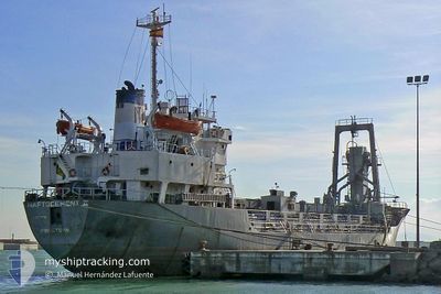
ZAYYAN K
Bulk Carrier
Current Trip
| Time Travelled | 8 days |
|---|---|
| Remaining Time | --- |
| Distance Travelled | 726.34 nm |
| Remaining Distance | --- |
| AVG Speed | 10.1 Knots |
| MAX Speed | 10.1 Knots |
| AVG Wind | 10.5 knots |
| MAX Wind | 21.8 knots |
| MIN Temp | 19.9°C / 67.82°F |
| MAX Temp | 27.4°C / 81.32°F |
| Draught | 3.5 m |
| Position Received | 54 m ago |
Current Position
| Longitude | 33.82072° |
|---|---|
| Latitude | 31.19431° |
| Status | At anchor |
| Speed | 0.1 Knots |
| Course | 134° |
| Area | Mediterranean Sea - Eastern Basin |
| Station | T-AIS |
| Position Received | 54 m ago |
Info
Information
The current position of ZAYYAN K is in Mediterranean Sea - Eastern Basin with coordinates 31.19431° / 33.82072° as reported on 2024-05-31 22:42 by AIS to our vessel tracker app. The vessel's current speed is 0.1 Knots
The vessel ZAYYAN K (IMO: 7394321, MMSI: 375369000) is a Bulk Carrier that was built in 1974 ( 50 years old ). It's sailing under the flag of [VC] St Vincent Grenadines.
In this page you can find informations about the vessels current position, last detected port calls, and current voyage information. If the vessels is not in coverage by AIS you will find the latest position.
The current position of ZAYYAN K is detected by our AIS receivers and we are not responsible for the reliability of the data. The last position was recorded while the vessel was in Coverage by the Ais receivers of our vessel tracking app.
The current draught of ZAYYAN K as reported by AIS is 3.5 meters
Weather
| Temperature | 22.5°C / 72.5°F |
|---|---|
| Wind Speed | 5 knots |
| Direction | 86° E |
| Pressure | 1017.9 hPa |
| Humidity | 65.5 % |
| Cloud Coverage | --- |
Featured Company
Last Port Calls
Events
| Time | Event | Details | Position / Dest | Info |
|---|---|---|---|---|
| 2024-05-31 22:44 | Status Changed | Default At anchor |
31.19432 / 33.82070
AL ARISH(EGYPT)
|
Speed: 0.1 kn Course: 134° |
| 2024-05-31 22:04 | Status Changed | At anchor Default |
31.19407 / 33.82057
AL ARISH(EGYPT)
|
Speed: 0.1 kn Course: 119° |
| 2024-05-31 21:46 | IN Coverage |
31.19407 / 33.82057
Mediterranean Sea - Eastern Basin
|
Speed: 0.1 kn Course: 231.1° |
|
| 2024-05-31 17:27 | Status Changed | Default At anchor |
31.19197 / 33.82156
AL ARISH(EGYPT)
|
Speed: Course: 6° |
| 2024-05-31 17:24 | OUT of Coverage |
31.19294 / 33.82101
Mediterranean Sea - Eastern Basin
|
Speed: Course: 12.3° |
|
| 2024-05-31 16:50 | Status Changed | At anchor Default |
31.19307 / 33.82075
AL ARISH(EGYPT)
|
Speed: 0.2 kn Course: 11° |
| 2024-05-31 16:17 | Status Changed | Default At anchor |
31.19294 / 33.82104
AL ARISH(EGYPT)
|
Speed: 0.1 kn Course: 0° |
| 2024-05-31 15:16 | IN Coverage |
31.19291 / 33.82135
Mediterranean Sea - Eastern Basin
|
Speed: 0.1 kn Course: 314.5° |
|
| 2024-05-31 15:13 | Status Changed | At anchor Default |
31.19292 / 33.82130
AL ARISH(EGYPT)
|
Speed: 0.1 kn Course: 345° |
| 2024-05-31 11:46 | OUT of Coverage |
31.19291 / 33.82158
Mediterranean Sea - Eastern Basin
|
Speed: 0.1 kn Course: 273.2° |