
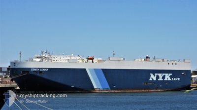
ZENITH LEADER
Cargo
Current Trip
| Time Travelled | 19 days |
|---|---|
| Remaining Time | --- |
| Distance Travelled | 5614.15 nm |
| Remaining Distance | --- |
| AVG Speed | 12.3 Knots |
| MAX Speed | 19.1 Knots |
| AVG Wind | 10.6 knots |
| MAX Wind | 33.5 knots |
| MIN Temp | 15.1°C / 59.18°F |
| MAX Temp | 30.9°C / 87.62°F |
| Draught | 8 m |
| Position Received | 4 d ago |
Current Position
| Longitude | -129.27797° |
|---|---|
| Latitude | 33.91472° |
| Status | Under way using engine |
| Speed | 11.9 Knots |
| Course | 303° |
| Area | North Pacific Ocean |
| Station | T-AIS |
| Position Received | 4 d ago |
Info
Information
The current position of ZENITH LEADER is in North Pacific Ocean with coordinates 33.91472° / -129.27797° as reported on 2024-06-04 02:21 by AIS to our vessel tracker app. The vessel's current speed is 11.9 Knots and is heading at the port of TOYOHASHI. The estimated time of arrival as calculated by vessel tracking app is 2024-06-20 03:00 LT
The vessel ZENITH LEADER (IMO: 938494200, MMSI: 235058697) is a Cargo It's sailing under the flag of [GB] United Kingdom.
In this page you can find informations about the vessels current position, last detected port calls, and current voyage information. If the vessels is not in coverage by AIS you will find the latest position.
The current position of ZENITH LEADER is detected by our AIS receivers and we are not responsible for the reliability of the data. The last position was recorded while the vessel was in Coverage by the Ais receivers of our vessel tracking app.
The current draught of ZENITH LEADER as reported by AIS is 8 meters
Weather
| Temperature | 17.2°C / 62.96°F |
|---|---|
| Wind Speed | 22 knots |
| Direction | 201° SSW |
| Pressure | 1014.4 hPa |
| Humidity | 78.8 % |
| Cloud Coverage | 100 % |
Featured Company
Last Port Calls
| Port | Arrival | Departure | Time In Port |
|---|---|---|---|
| 2024-05-19 09:40 | 2024-05-19 21:19 | 11 h | |
| 2024-05-14 00:30 | 2024-05-15 01:17 | 1 d | |
| 2024-05-10 21:22 | 2024-05-11 18:38 | 21 h | |
| 2024-04-14 21:09 | 2024-04-16 09:31 | 1 d |
Most Visited Ports (Last year)
| Port | Arrivals | |
|---|---|---|
| 6 | ||
| 3 | ||
| 3 | ||
| 2 | ||
| 2 | ||
| 2 |
Last Trips
| Origin | Departure | Destination | Arrival | Distance | |
|---|---|---|---|---|---|
| 2024-05-14 21:17 | 2024-05-19 05:40 | 1418.29 nm | |||
| 2024-05-11 14:38 | 2024-05-13 20:30 | 815.69 nm | |||
| 2024-04-16 18:31 | 2024-05-10 17:22 | 9478.22 nm | |||
| 2024-03-12 21:43 | 2024-04-15 06:09 | 10370.04 nm |
Events
| Time | Event | Details | Position / Dest | Info |
|---|---|---|---|---|
| 2024-06-04 02:24 | Status Changed | Default Under way using engine |
33.91958 / -129.28691
JP THS
|
Speed: 11.9 kn Course: 303° |
| 2024-06-04 02:21 | Change Sea Area | High seas of the North Pacific Ocean Mexican part of the North Pacific Ocean |
33.91472 / -129.27797
North Pacific Ocean
JP THS
|
Speed: 11.9 kn Course: 303° |
| 2024-06-04 02:21 | Status Changed | Under way using engine Default |
33.91472 / -129.27797
JP THS
|
Speed: 11.8 kn Course: 303° |
| 2024-06-04 02:21 | IN Coverage |
33.91472 / -129.27797
North Pacific Ocean
JP THS
|
Speed: 11.9 kn Course: 303° |
|
| 2024-06-04 02:21 | OUT of Coverage |
33.91472 / -129.27797
North Pacific Ocean
JP THS
|
Speed: 11.9 kn Course: 303° |
|
| 2024-06-01 20:11 | Status Changed | Default Under way using engine |
28.17912 / -118.94877
JP THS
|
Speed: 12.1 kn Course: 309° |
| 2024-06-01 20:05 | OUT of Coverage |
28.16690 / -118.93197
North Pacific Ocean
JP THS
|
Speed: 12.1 kn Course: 309° |
|
| 2024-06-01 19:41 | Status Changed | Under way using engine Default |
28.11670 / -118.86227
JP THS
|
Speed: 12 kn Course: 309° |
| 2024-06-01 19:35 | Status Changed | Default Under way using engine |
28.10353 / -118.84412
JP THS
|
Speed: 12.3 kn Course: 309° |
| 2024-06-01 19:23 | Status Changed | Under way using engine Default |
28.07833 / -118.80910
JP THS
|
Speed: 12.3 kn Course: 308° |