
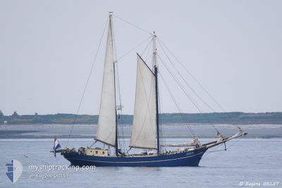
ZEPHYR
Sailing
Current Trip
| Time Travelled | 3 h, 58 mins |
|---|---|
| Remaining Time | 4 h, 29 mins |
| Distance Travelled | 7.07 nm |
| Remaining Distance | 20.00 nm |
| AVG Speed | 3.9 Knots |
| MAX Speed | 5.1 Knots |
| AVG Wind | 6.8 knots |
| MAX Wind | 8 knots |
| MIN Temp | 15.8°C / 60.44°F |
| MAX Temp | 16.6°C / 61.88°F |
| Draught | 1.9 m |
| Position Received | Now |
Current Position
| Longitude | 10.16448° |
|---|---|
| Latitude | 54.66265° |
| Status | Under way sailing |
| Speed | 0.3 Knots |
| Course | --- |
| Area | Baltic Sea |
| Station | T-AIS |
| Position Received | Now |
Info
Information
The current position of ZEPHYR is in Baltic Sea with coordinates 54.66265° / 10.16448° as reported on 2024-06-01 11:11 by AIS to our vessel tracker app. The vessel's current speed is 0.3 Knots and is heading at the port of KIEL. The estimated time of arrival as calculated by vessel tracking app is 2024-06-01 15:40 LT
The vessel ZEPHYR (MMSI: 245115000) is a Sailing It's sailing under the flag of [NL] Netherlands.
In this page you can find informations about the vessels current position, last detected port calls, and current voyage information. If the vessels is not in coverage by AIS you will find the latest position.
The current position of ZEPHYR is detected by our AIS receivers and we are not responsible for the reliability of the data. The last position was recorded while the vessel was in Coverage by the Ais receivers of our vessel tracking app.
The current draught of ZEPHYR as reported by AIS is 1.9 meters
Weather
| Temperature | 17°C / 62.6°F |
|---|---|
| Wind Speed | 4 knots |
| Direction | 22° NNE |
| Pressure | 1014.7 hPa |
| Humidity | 84.8 % |
| Cloud Coverage | 93 % |
Featured Company
Last Port Calls
| Port | Arrival | Departure | Time In Port |
|---|---|---|---|
| 2024-05-31 15:17 | 2024-06-01 07:13 | 15 h | |
| 2024-05-30 16:18 | 2024-05-31 06:59 | 14 h | |
| 2024-05-26 12:10 | 2024-05-30 07:37 | 3 d | |
| 2024-05-25 14:54 | 2024-05-26 07:49 | 16 h | |
| 2024-05-18 14:48 | 2024-05-25 07:55 | 6 d | |
| 2024-05-15 12:09 | 2024-05-18 11:27 | 2 d | |
| 2024-05-11 19:22 | 2024-05-13 08:06 | 1 d | |
| 2024-05-09 13:14 | 2024-05-11 19:04 | 2 d | |
| 2024-05-08 12:42 | 2024-05-09 12:18 | 23 h | |
| 2024-05-06 22:26 | 2024-05-08 09:52 | 1 d |
Most Visited Ports (Last year)
| Port | Arrivals | |
|---|---|---|
| 20 | ||
| 13 | ||
| 6 | ||
| 5 | ||
| 5 | ||
| 5 |
Last Trips
| Origin | Departure | Destination | Arrival | Distance | |
|---|---|---|---|---|---|
| 2024-05-31 08:59 | 2024-05-31 17:17 | 32.50 nm | |||
| 2024-05-30 09:37 | 2024-05-30 18:18 | 33.15 nm | |||
| 2024-05-26 09:49 | 2024-05-26 14:10 | 18.90 nm | |||
| 2024-05-25 09:55 | 2024-05-25 16:54 | 19.50 nm | |||
| 2024-05-18 13:27 | 2024-05-18 16:48 | 10.12 nm | |||
| 2024-05-13 10:06 | 2024-05-15 14:09 | 89.35 nm | |||
| 2024-05-11 21:04 | 2024-05-11 21:22 | 0.83 nm | |||
| 2024-05-09 14:18 | 2024-05-09 15:14 | 3.12 nm | |||
| 2024-05-08 11:52 | 2024-05-08 14:42 | 23.98 nm | |||
| 2024-05-06 09:19 | 2024-05-07 00:26 | 92.06 nm |
Events
| Time | Event | Details | Position / Dest | Info |
|---|---|---|---|---|
| 2024-06-01 09:54 | STOP Moving | 4.51 nm, East of OLPENITZ |
54.66993 / 10.16350
KIEL
|
Speed: 0.3 kn Course: 511° |
| 2024-06-01 07:48 | Destination Changed | KIEL MAASHOLM |
54.67315 / 10.02892
KIEL
|
Speed: 4.8 kn Course: 122° |
| 2024-06-01 07:48 | ETA Changed | 2024/06/01 19:00 2025/05/31 17:00 |
54.67315 / 10.02892
KIEL
|
Speed: 4.8 kn Course: 122° |
| 2024-06-01 07:32 | START Moving | 0.44 nm, South East of MAASHOLM |
54.67720 / 9.99892
MAASHOLM
|
Speed: 3.1 kn Course: 111.6° |
| 2024-06-01 07:13 | PORT DEPARTURE |
|
54.67863 / 9.99220
MAASHOLM
|
Speed: 2.6 kn Course: 511° |
| 2024-06-01 00:02 | ETA Changed | 2025/05/31 17:00 2024/05/31 17:00 |
54.68197 / 9.99115
[DE] MAASHOLM
|
Speed: 0.1 kn Course: 511° |
| 2024-05-31 15:18 | STOP Moving |
54.68042 / 9.99167
[DE] MAASHOLM
|
Speed: 0.3 kn Course: 511° |
|
| 2024-05-31 15:17 | PORT ARRIVAL |
|
54.68012 / 9.99173
[DE] MAASHOLM
|
Speed: 2.9 kn Course: 511° |
| 2024-05-31 11:34 | Change Sea Area | German part of the Baltic Sea Danish part of the Baltic Sea |
54.75398 / 10.21852
Baltic Sea
MAASHOLM
|
Speed: 4.6 kn Course: 278.2° |
| 2024-05-31 08:07 | Change Sea Area | Danish part of the Baltic Sea Danish part of the Kattegat |
54.76933 / 10.55680
Baltic Sea
MAASHOLM
|
Speed: 5.8 kn Course: 179.2° |