
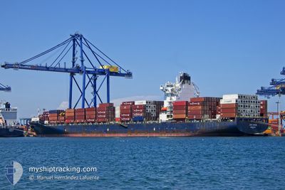
ZIM CHINA
Container Ship
Current Trip
ILTHB
| Time Travelled | 8 days |
|---|---|
| Remaining Time | --- |
| Distance Travelled | 2691.17 nm |
| Remaining Distance | --- |
| AVG Speed | 14.4 Knots |
| MAX Speed | 19.8 Knots |
| AVG Wind | 14.4 knots |
| MAX Wind | 25 knots |
| MIN Temp | 18.8°C / 65.84°F |
| MAX Temp | 24.3°C / 75.74°F |
| Draught | 9.9 m |
| Position Received | 1 m ago |
Current Position
| Longitude | -26.81383° |
|---|---|
| Latitude | 38.43212° |
| Status | Under way using engine |
| Speed | 16.9 Knots |
| Course | 94° |
| Area | North Atlantic Ocean |
| Station | T-AIS |
| Position Received | 1 m ago |
Info
Information
The current position of ZIM CHINA is in North Atlantic Ocean with coordinates 38.43212° / -26.81383° as reported on 2024-05-28 23:41 by AIS to our vessel tracker app. The vessel's current speed is 16.9 Knots
The vessel ZIM CHINA (IMO: 9389382, MMSI: 636021739) is a Container Ship that was built in 2008 ( 16 years old ). It's sailing under the flag of [LR] Liberia.
In this page you can find informations about the vessels current position, last detected port calls, and current voyage information. If the vessels is not in coverage by AIS you will find the latest position.
The current position of ZIM CHINA is detected by our AIS receivers and we are not responsible for the reliability of the data. The last position was recorded while the vessel was in Coverage by the Ais receivers of our vessel tracking app.
The current draught of ZIM CHINA as reported by AIS is 9.9 meters
Weather
| Temperature | 19.2°C / 66.56°F |
|---|---|
| Wind Speed | 18 knots |
| Direction | 194° SSW |
| Pressure | 1020.6 hPa |
| Humidity | 87.1 % |
| Cloud Coverage | 6 % |
Featured Company
Last Port Calls
| Port | Arrival | Departure | Time In Port |
|---|---|---|---|
| 2024-05-19 20:40 | 2024-05-20 11:01 | 14 h | |
| 2024-05-17 12:19 | 2024-05-18 02:56 | 14 h | |
| 2024-05-13 08:15 | 2024-05-14 03:33 | 19 h | |
| 2024-05-11 09:40 | 2024-05-11 20:31 | 10 h | |
| 2024-05-01 15:11 | 2024-05-02 15:06 | 23 h | |
| 2024-04-29 23:21 | 2024-04-30 13:21 | 13 h | |
| 2024-04-27 12:02 | 2024-04-28 14:05 | 1 d | |
| 2024-04-23 04:38 | 2024-04-23 20:53 | 16 h | |
| 2024-04-21 10:50 | 2024-04-22 08:49 | 21 h | |
| 2024-04-16 08:03 | 2024-04-17 11:37 | 1 d |
Last Trips
| Origin | Departure | Destination | Arrival | Distance | |
|---|---|---|---|---|---|
| 2024-05-17 22:56 | 2024-05-19 16:40 | 498.95 nm | |||
| 2024-05-13 23:33 | 2024-05-17 08:19 | 297.20 nm | |||
| 2024-05-11 17:31 | 2024-05-13 04:15 | 589.27 nm | |||
| 2024-05-02 17:06 | 2024-05-11 06:40 | 3112.46 nm | |||
| 2024-04-30 15:21 | 2024-05-01 17:11 | 169.54 nm | |||
| 2024-04-28 16:05 | 2024-04-30 01:21 | 361.54 nm | |||
| 2024-04-23 23:53 | 2024-04-27 14:02 | 983.08 nm | |||
| 2024-04-22 11:49 | 2024-04-23 07:38 | 192.93 nm | |||
| 2024-04-17 14:37 | 2024-04-21 13:50 | 802.41 nm | |||
| 2024-04-15 11:18 | 2024-04-16 11:03 | 353.73 nm |
Events
| Time | Event | Details | Position / Dest | Info |
|---|---|---|---|---|
| 2024-05-28 19:07 | Destination Changed | ILTHB ESVLC |
38.63273 / -28.42108
ILTHB
|
Speed: 17.5 kn Course: 106° |
| 2024-05-28 19:07 | ETA Changed | 2024/06/06 18:00 2024/06/04 18:00 |
38.63273 / -28.42108
ILTHB
|
Speed: 17.5 kn Course: 106° |
| 2024-05-28 13:08 | Status Changed | Under way using engine Default |
38.80037 / -30.62883
ESVLC
|
Speed: 17.1 kn Course: 92° |
| 2024-05-28 12:47 | Status Changed | Default Under way using engine |
38.80647 / -30.75965
ESVLC
|
Speed: 17.4 kn Course: 91° |
| 2024-05-28 12:31 | Change Sea Area | Portuguese (Azores) part of the North Atlantic Ocean High seas of the North Atlantic Ocean |
38.80887 / -30.85613
North Atlantic Ocean
ESVLC
|
Speed: 17.2 kn Course: 91° |
| 2024-05-28 12:31 | Status Changed | Under way using engine Default |
38.80887 / -30.85613
ESVLC
|
Speed: 17.1 kn Course: 91° |
| 2024-05-28 12:31 | IN Coverage |
38.80887 / -30.85613
North Atlantic Ocean
ESVLC
|
Speed: 17.2 kn Course: 91° |
|
| 2024-05-24 06:32 | Status Changed | Default Under way using engine |
35.64715 / -61.86868
ESVLC
|
Speed: 10.9 kn Course: 74° |
| 2024-05-24 06:26 | Status Changed | Under way using engine Default |
35.64203 / -61.89086
ESVLC
|
Speed: 11 kn Course: 74° |
| 2024-05-24 06:26 | OUT of Coverage |
35.64203 / -61.89086
North Atlantic Ocean
ESVLC
|
Speed: 10.9 kn Course: 74° |