
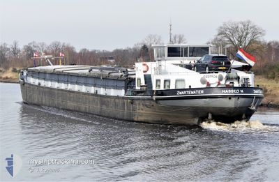
ZWARTEWATER
Cargo
Current Trip
MEPPEL
Unknown Port
ETA*
2024-12-28 09:53 UTC
| Time Travelled | 3 days |
|---|---|
| Remaining Time | --- |
| Distance Travelled | 31.89 nm |
| Remaining Distance | --- |
| AVG Speed | 6.9 Knots |
| MAX Speed | 9.6 Knots |
| AVG Wind | 5.8 knots |
| MAX Wind | 8.9 knots |
| MIN Temp | 10.2°C / 50.36°F |
| MAX Temp | 16.1°C / 60.98°F |
| Draught | 0 m |
| Position Received | 3 d ago |
Current Position
| Longitude | 6.17251° |
|---|---|
| Latitude | 52.08423° |
| Status | Under way using engine |
| Speed | 8.5 Knots |
| Course | 8.4° |
| Area | North Sea |
| Station | T-AIS |
| Position Received | 3 d ago |
Info
info
Information
The current position of ZWARTEWATER is in North Sea with coordinates 52.08423° / 6.17251° as reported on 2024-05-30 08:21 by AIS to our vessel tracker app. The vessel's current speed is 8.5 Knots
The vessel ZWARTEWATER (MMSI: 244670346) is a Cargo It's sailing under the flag of [NL] Netherlands.
In this page you can find informations about the vessels current position, last detected port calls, and current voyage information. If the vessels is not in coverage by AIS you will find the latest position.
The current position of ZWARTEWATER is detected by our AIS receivers and we are not responsible for the reliability of the data. The last position was recorded while the vessel was in Coverage by the Ais receivers of our vessel tracking app.
Weather
| Temperature | 15.9°C / 60.62°F |
|---|---|
| Wind Speed | 9 knots |
| Direction | 245° WSW |
| Pressure | 1005.1 hPa |
| Humidity | 82.2 % |
| Cloud Coverage | 12 % |
Featured Company
Limited time offer - Install a base station receiver to your area and list your company on Free forever!
Last Port Calls
| Port | Arrival | Departure | Time In Port |
|---|---|---|---|
| 2024-05-29 20:39 | 2024-05-30 03:43 | 7 h | |
| 2024-05-23 06:57 | 2024-05-23 14:01 | 7 h | |
| 2024-05-22 20:58 | 2024-05-23 06:51 | 9 h | |
| 2024-05-22 15:08 | 2024-05-22 15:42 | 33 m | |
| 2024-05-21 16:38 | 2024-05-22 13:53 | 21 h | |
| 2024-05-16 22:27 | 2024-05-16 22:50 | 23 m | |
| 2024-05-15 18:04 | 2024-05-16 13:43 | 19 h | |
| 2024-05-13 14:42 | 2024-05-15 11:57 | 1 d | |
| 2024-05-08 14:46 | 2024-05-13 09:15 | 4 d | |
| 2024-05-07 20:03 | 2024-05-08 03:13 | 7 h |
Most Visited Ports (Last year)
| Port | Arrivals | |
|---|---|---|
| 19 | ||
| 14 | ||
| 7 | ||
| 6 | ||
| 6 | ||
| 6 |
Last Trips
| Origin | Departure | Destination | Arrival | Distance | |
|---|---|---|---|---|---|
| 2024-05-23 16:01 | 2024-05-29 22:39 | 178.21 nm | |||
| 2024-05-23 08:51 | 2024-05-23 08:57 | 1.17 nm | |||
| 2024-05-22 17:42 | 2024-05-22 22:58 | 43.26 nm | |||
| 2024-05-22 15:53 | 2024-05-22 17:08 | 1.70 nm | |||
| 2024-05-17 00:50 | 2024-05-21 18:38 | 7.23 nm | |||
| 2024-05-16 15:43 | 2024-05-17 00:27 | 52.78 nm | |||
| 2024-05-15 13:57 | 2024-05-15 20:04 | 46.63 nm | |||
| 2024-05-13 11:15 | 2024-05-13 16:42 | 38.35 nm | |||
| 2024-05-08 05:13 | 2024-05-08 16:46 | 76.09 nm | |||
| 2024-05-07 21:31 | 2024-05-07 22:03 | 3.42 nm |
Events
| Time | Event | Details | Position / Dest | Info |
|---|---|---|---|---|
| 2024-05-30 08:21 | OUT of Coverage |
52.08423 / 6.17251
North Sea
|
Speed: 8.5 kn Course: 8.4° |
|
| 2024-05-30 03:43 | PORT DEPARTURE |
|
51.86282 / 5.83317
MEPPEL
|
Speed: 3.8 kn Course: 114.2° |
| 2024-05-30 03:30 | START Moving |
51.85540 / 5.82414
[NL] NIJMEGEN
|
Speed: 3.2 kn Course: 25.5° |
|
| 2024-05-29 20:39 | PORT ARRIVAL |
|
51.84930 / 5.81942
[NL] NIJMEGEN
|
Speed: 0.3 kn Course: 511° |
| 2024-05-29 20:39 | STOP Moving | 0.21 nm, North West of NIJMEGEN |
51.84931 / 5.81933
MEPPEL
|
Speed: 0.3 kn Course: 511° |
| 2024-05-29 18:32 | START Moving | 1.85 nm, South East of BOXMEER |
51.64124 / 5.97911
MEPPEL
|
Speed: 4 kn Course: 299.7° |
| 2024-05-29 18:17 | STOP Moving | 1.96 nm, South East of BOXMEER |
51.64015 / 5.98199
MEPPEL
|
Speed: 0.2 kn Course: 511° |
| 2024-05-29 17:48 | IN Coverage |
51.59546 / 6.02616
North Sea
|
Speed: 8.1 kn Course: 333.9° |
|
| 2024-05-29 13:22 | OUT of Coverage |
51.20121 / 5.95101
North Sea
|
Speed: 5.9 kn Course: 48.5° |
|
| 2024-05-29 10:45 | START Moving | 1.5 nm, South West of BARGE TERMINAL BORN |
51.03695 / 5.79942
MEPPEL
|
Speed: 3.6 kn Course: 14.3° |