
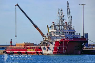
BOS TETHYS
Offshore Supply Ship
Current Trip
EGAKI
| Time Travelled | 5 days |
|---|---|
| Remaining Time | --- |
| Distance Travelled | 28.33 nm |
| Remaining Distance | --- |
| AVG Speed | 18.4 Knots |
| MAX Speed | 18.4 Knots |
| AVG Wind | 9.6 knots |
| MAX Wind | 17 knots |
| MIN Temp | 19.9°C / 67.82°F |
| MAX Temp | 24.6°C / 76.28°F |
| Draught | 4.1 m |
| Position Received | 9 h, 43 m ago |
Current Position
| Longitude | 30.07746° |
|---|---|
| Latitude | 31.38004° |
| Status | At anchor |
| Speed | |
| Course | 26° |
| Area | Mediterranean Sea - Eastern Basin |
| Station | T-AIS |
| Position Received | 9 h, 43 m ago |
Info
Information
The current position of BOS TETHYS is in Mediterranean Sea - Eastern Basin with coordinates 31.38004° / 30.07746° as reported on 2024-05-18 15:16 by AIS to our vessel tracker app. The vessel's current speed is 0 Knots
The vessel BOS TETHYS (IMO: 9552630, MMSI: 247280800) is a Offshore Supply Ship that was built in 2010 ( 14 years old ). It's sailing under the flag of [IT] Italy.
In this page you can find informations about the vessels current position, last detected port calls, and current voyage information. If the vessels is not in coverage by AIS you will find the latest position.
The current position of BOS TETHYS is detected by our AIS receivers and we are not responsible for the reliability of the data. The last position was recorded while the vessel was in Coverage by the Ais receivers of our vessel tracking app.
The current draught of BOS TETHYS as reported by AIS is 4.1 meters
Weather
| Temperature | 22.5°C / 72.5°F |
|---|---|
| Wind Speed | 2 knots |
| Direction | 75° ENE |
| Pressure | 1012.9 hPa |
| Humidity | 73.4 % |
| Cloud Coverage | 62 % |
Featured Company
Last Port Calls
| Port | Arrival | Departure | Time In Port |
|---|---|---|---|
| 2024-05-13 07:55 | 2024-05-13 14:45 | 6 h | |
| 2024-05-08 15:40 | 2024-05-09 04:35 | 12 h | |
| 2024-05-07 09:22 | 2024-05-08 10:11 | 1 d | |
| 2024-05-04 11:13 | 2024-05-04 11:31 | 18 m | |
| 2024-04-23 05:44 | 2024-04-30 08:30 | 7 d | |
| 2024-03-31 08:04 | 2024-04-21 07:37 | 20 d | |
| 2024-03-26 09:03 | 2024-03-26 16:40 | 7 h |
Last Trips
| Origin | Departure | Destination | Arrival | Distance | |
|---|---|---|---|---|---|
| 2024-05-09 06:35 | 2024-05-13 09:55 | 31.16 nm | |||
| 2024-05-08 12:11 | 2024-05-08 17:40 | 15.86 nm | |||
| 2024-05-04 13:31 | 2024-05-07 11:22 | 26.82 nm | |||
| 2024-04-30 10:30 | 2024-05-04 13:13 | 820.51 nm | |||
| 2024-04-21 09:37 | 2024-04-23 07:44 | 162.63 nm | |||
| 2024-03-26 17:40 | 2024-03-31 10:04 | 765.66 nm | |||
| 2024-02-27 17:11 | 2024-03-26 10:03 | 1388.29 nm |
Events
| Time | Event | Details | Position / Dest | Info |
|---|---|---|---|---|
| 2024-05-18 15:22 | Status Changed | Default At anchor |
31.38004 / 30.07744
EGAKI
|
Speed: Course: 26° |
| 2024-05-18 15:16 | OUT of Coverage |
31.38004 / 30.07746
Mediterranean Sea - Eastern Basin
|
Speed: Course: 273.8° |
|
| 2024-05-18 15:13 | Status Changed | At anchor Default |
31.38004 / 30.07753
EGAKI
|
Speed: 0.1 kn Course: 25° |
| 2024-05-18 15:13 | IN Coverage |
31.38004 / 30.07753
Mediterranean Sea - Eastern Basin
|
Speed: 0.1 kn Course: 228.3° |
|
| 2024-05-17 13:07 | Status Changed | Default At anchor |
31.37918 / 30.07641
EGAKI
|
Speed: 4 kn Course: 89° |
| 2024-05-17 13:03 | Status Changed | At anchor Default |
31.37988 / 30.07619
EGAKI
|
Speed: 0.3 kn Course: 29° |
| 2024-05-17 13:03 | OUT of Coverage |
31.37988 / 30.07619
Mediterranean Sea - Eastern Basin
|
Speed: 4 kn Course: 38.7° |
|
| 2024-05-17 12:57 | Status Changed | Default At anchor |
31.37938 / 30.07647
EGAKI
|
Speed: 0.3 kn Course: 81° |
| 2024-05-17 12:38 | Status Changed | At anchor Default |
31.38100 / 30.07673
EGAKI
|
Speed: 0.3 kn Course: 67° |
| 2024-05-17 12:38 | IN Coverage |
31.37977 / 30.07592
Mediterranean Sea - Eastern Basin
|
Speed: 28.6 kn Course: 295.2° |