
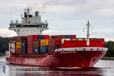
CONTAINERSHIPS VIII
Container Ship
Current Trip
| Trip Time | 2 days |
|---|---|
| Trip Distance | 93.44 nm |
| AVG Speed | 15.3 Knots |
| MAX Speed | 17.8 Knots |
| Draught | 7.6 m |
| AVG Wind | 17.9 knots |
| MAX Wind | 21.4 knots |
| MIN Temp | 10.8°C / 51.44°F |
| MAX Temp | 15.4°C / 59.72°F |
| Position Received | 4 m ago |
Current Position
| Longitude | 10.23869° |
|---|---|
| Latitude | 56.15308° |
| Status | Moored |
| Speed | |
| Course | 45° |
| Area | Kattegat |
| Station | T-AIS |
| Position Received | 4 m ago |
Info
Information
The current position of CONTAINERSHIPS VIII is in Kattegat with coordinates 56.15308° / 10.23869° as reported on 2024-05-18 10:05 by AIS to our vessel tracker app. The vessel's current speed is 0 Knots and is currently inside the port of AARHUS.
The vessel CONTAINERSHIPS VIII (IMO: 9336244, MMSI: 211845000) is a Container Ship that was built in 2006 ( 18 years old ). It's sailing under the flag of [DE] Germany.
In this page you can find informations about the vessels current position, last detected port calls, and current voyage information. If the vessels is not in coverage by AIS you will find the latest position.
The current position of CONTAINERSHIPS VIII is detected by our AIS receivers and we are not responsible for the reliability of the data. The last position was recorded while the vessel was in Coverage by the Ais receivers of our vessel tracking app.
The current draught of CONTAINERSHIPS VIII as reported by AIS is 7.6 meters
Weather
| Temperature | 18.4°C / 65.12°F |
|---|---|
| Wind Speed | 8 knots |
| Direction | 96° E |
| Pressure | 1015.6 hPa |
| Humidity | 57.6 % |
| Cloud Coverage | 1 % |
Featured Company
Last Port Calls
| Port | Arrival | Departure | Time In Port |
|---|---|---|---|
| 2024-05-18 06:48 | |||
| 2024-05-15 11:20 | 2024-05-16 03:20 | 16 h | |
| 2024-05-13 01:15 | 2024-05-13 15:05 | 13 h | |
| 2024-05-12 22:59 | 2024-05-12 23:07 | 8 m | |
| 2024-05-12 09:27 | |||
| 2024-05-11 16:40 | 2024-05-12 07:44 | 15 h | |
| 2024-05-04 18:04 | 2024-05-05 12:14 | 18 h | |
| 2024-05-03 19:20 | 2024-05-04 12:39 | 17 h | |
| 2024-05-01 03:50 | 2024-05-01 22:34 | 18 h | |
| 2024-04-30 18:59 | 2024-05-01 01:42 | 6 h |
Most Visited Ports (Last year)
| Port | Arrivals | |
|---|---|---|
| 22 | ||
| 18 | ||
| 15 | ||
| 12 | ||
| 10 | ||
| 9 |
Last Trips
| Origin | Departure | Destination | Arrival | Distance | |
|---|---|---|---|---|---|
| 2024-05-16 05:20 | 2024-05-18 08:48 | 93.44 nm | |||
| 2024-05-13 17:05 | 2024-05-15 13:20 | 584.74 nm | |||
| 2024-05-13 01:07 | 2024-05-13 03:15 | 16.02 nm | |||
| 2024-05-12 09:44 | 2024-05-13 00:59 | 17.27 nm | |||
| 2024-05-12 09:44 | 2024-05-12 11:27 | 16.47 nm | |||
| 2024-05-05 14:14 | 2024-05-11 18:40 | 640.42 nm | |||
| 2024-05-04 14:39 | 2024-05-04 20:04 | 90.35 nm | |||
| 2024-05-02 00:34 | 2024-05-03 21:20 | 593.84 nm | |||
| 2024-05-01 03:42 | 2024-05-01 05:50 | 16.42 nm | |||
| 2024-04-30 20:53 | 2024-04-30 20:59 | 0.58 nm |
Events
| Time | Event | Details | Position / Dest | Info |
|---|---|---|---|---|
| 2024-05-18 07:32 | Status Changed | Moored Under way using engine |
56.15309 / 10.23870
[DK] AARHUS
|
Speed: 0.1 kn Course: 40° |
| 2024-05-18 06:58 | STOP Moving |
56.15990 / 10.24301
[DK] AARHUS
|
Speed: 0.3 kn Course: 350° |
|
| 2024-05-18 06:48 | PORT ARRIVAL |
|
56.15867 / 10.24850
[DK] AARHUS
|
Speed: 1.8 kn Course: 296° |
| 2024-05-18 06:02 | START Moving | 5.43 nm, South East of AARHUS |
56.10483 / 10.36283
DKAAR
|
Speed: 3.3 kn Course: 40° |
| 2024-05-18 05:56 | Status Changed | Under way using engine At anchor |
56.10415 / 10.36018
DKAAR
|
Speed: 0.3 kn Course: 61° |
| 2024-05-16 09:04 | Status Changed | At anchor Under way using engine |
56.10438 / 10.35932
DKAAR
|
Speed: 0.6 kn Course: 71° |
| 2024-05-16 09:03 | STOP Moving | 5.36 nm, South East of AARHUS |
56.10439 / 10.35960
DKAAR
|
Speed: 0.3 kn Course: 72° |
| 2024-05-16 04:50 | ETA Changed | 2024/05/16 08:45 2024/05/16 10:30 |
56.19917 / 12.15517
DKAAR
|
Speed: 16.3 kn Course: 252° |
| 2024-05-16 04:25 | Change Sea Area | Danish part of the Kattegat Swedish part of the Kattegat |
56.21183 / 12.36067
Kattegat
DKAAR
|
Speed: 16.2 kn Course: 270° |
| 2024-05-16 03:20 | PORT DEPARTURE |
|
56.01886 / 12.69217
DKAAR
|
Speed: 9 kn Course: 217° |