
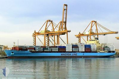
GSL LALO
Container Ship
Current Trip
| Time Travelled | 2 days |
|---|---|
| Remaining Time | 1 day |
| Distance Travelled | 975.94 nm |
| Remaining Distance | 618.47 nm |
| AVG Speed | 15.8 Knots |
| MAX Speed | 18.1 Knots |
| AVG Wind | 15 knots |
| MAX Wind | 30.5 knots |
| MIN Temp | 12.8°C / 55.04°F |
| MAX Temp | 18.7°C / 65.66°F |
| Draught | 8.5 m |
| Position Received | 8 h, 36 m ago |
Current Position
| Longitude | -9.24780° |
|---|---|
| Latitude | 43.95325° |
| Status | Under way using engine |
| Speed | 17.3 Knots |
| Course | 29.5° |
| Area | North Atlantic Ocean |
| Station | T-AIS |
| Position Received | 8 h, 36 m ago |
Info
Information
The current position of GSL LALO is in North Atlantic Ocean with coordinates 43.95325° / -9.24780° as reported on 2024-05-18 02:50 by AIS to our vessel tracker app. The vessel's current speed is 17.3 Knots and is heading at the port of ROTTERDAM. The estimated time of arrival as calculated by vessel tracking app is 2024-05-20 01:06 LT
The vessel GSL LALO (IMO: 9330525, MMSI: 636021004) is a Container Ship that was built in 2006 ( 18 years old ). It's sailing under the flag of [LR] Liberia.
In this page you can find informations about the vessels current position, last detected port calls, and current voyage information. If the vessels is not in coverage by AIS you will find the latest position.
The current position of GSL LALO is detected by our AIS receivers and we are not responsible for the reliability of the data. The last position was recorded while the vessel was in Coverage by the Ais receivers of our vessel tracking app.
The current draught of GSL LALO as reported by AIS is 8.5 meters
Weather
| Temperature | 14.1°C / 57.38°F |
|---|---|
| Wind Speed | 13 knots |
| Direction | 26° NNE |
| Pressure | 1014 hPa |
| Humidity | 84.6 % |
| Cloud Coverage | 17 % |
Featured Company
Last Port Calls
| Port | Arrival | Departure | Time In Port |
|---|---|---|---|
| 2024-05-14 15:58 | 2024-05-15 22:42 | 1 d | |
| 2024-05-12 12:14 | 2024-05-13 01:26 | 13 h | |
| 2024-05-06 20:01 | 2024-05-07 10:26 | 14 h | |
| 2024-05-03 22:01 | 2024-05-05 00:04 | 1 d | |
| 2024-04-30 17:09 | 2024-05-02 15:16 | 1 d | |
| 2024-04-23 05:30 | 2024-04-23 22:18 | 16 h | |
| 2024-04-08 01:11 | 2024-04-09 09:02 | 1 d | |
| 2024-04-06 10:45 | 2024-04-07 03:53 | 17 h | |
| 2024-04-03 22:53 | 2024-04-05 01:48 | 1 d | |
| 2024-04-02 01:23 | 2024-04-02 13:52 | 12 h |
Most Visited Ports (Last year)
| Port | Arrivals | |
|---|---|---|
| 18 | ||
| 17 | ||
| 10 | ||
| 10 | ||
| 10 | ||
| 9 |
Last Trips
| Origin | Departure | Destination | Arrival | Distance | |
|---|---|---|---|---|---|
| 2024-05-13 02:26 | 2024-05-14 16:58 | 355.95 nm | |||
| 2024-05-07 10:26 | 2024-05-12 13:14 | 1955.57 nm | |||
| 2024-05-05 00:04 | 2024-05-06 20:01 | 281.02 nm | |||
| 2024-05-02 15:16 | 2024-05-03 22:01 | 436.49 nm | |||
| 2024-04-23 22:18 | 2024-04-30 17:09 | 613.76 nm | |||
| 2024-04-09 04:02 | 2024-04-23 05:30 | 4489.21 nm | |||
| 2024-04-06 22:53 | 2024-04-07 20:11 | 286.49 nm | |||
| 2024-04-04 20:48 | 2024-04-06 05:45 | 320.05 nm | |||
| 2024-04-02 08:52 | 2024-04-03 17:53 | 13.73 nm | |||
| 2024-03-30 14:20 | 2024-04-01 20:23 | 792.86 nm |
Events
| Time | Event | Details | Position / Dest | Info |
|---|---|---|---|---|
| 2024-05-18 02:55 | Status Changed | Default Under way using engine |
43.97500 / -9.22833
NLRTM
|
Speed: 17.3 kn Course: 29.5° |
| 2024-05-18 02:50 | OUT of Coverage |
43.95325 / -9.24780
North Atlantic Ocean
NLRTM
|
Speed: 17.3 kn Course: 29.5° |
|
| 2024-05-18 01:32 | ETA Changed | 2024/05/20 01:00 2024/05/20 03:00 |
43.61585 / -9.47872
NLRTM
|
Speed: 17.6 kn Course: 25.3° |
| 2024-05-18 01:03 | Status Changed | Under way using engine Default |
43.49232 / -9.56210
NLRTM
|
Speed: 17 kn Course: 28° |
| 2024-05-18 01:01 | Status Changed | Default Under way using engine |
43.48500 / -9.56667
NLRTM
|
Speed: 17.1 kn Course: 26.6° |
| 2024-05-18 00:25 | Change Sea Area | Spanish part of the North Atlantic Ocean Portuguese part of the North Atlantic Ocean |
43.32864 / -9.67818
North Atlantic Ocean
NLRTM
|
Speed: 17.1 kn Course: 28° |
| 2024-05-18 00:25 | Status Changed | Under way using engine Default |
43.32864 / -9.67818
NLRTM
|
Speed: 17 kn Course: 30° |
| 2024-05-18 00:07 | IN Coverage |
43.32864 / -9.67818
North Atlantic Ocean
NLRTM
|
Speed: 17.1 kn Course: 28° |
|
| 2024-05-17 12:59 | Status Changed | Default Under way using engine |
40.09095 / -9.81819
NLRTM
|
Speed: 16.6 kn Course: 1.2° |
| 2024-05-17 12:50 | OUT of Coverage |
40.05217 / -9.81887
North Atlantic Ocean
NLRTM
|
Speed: 16.6 kn Course: 1.2° |