
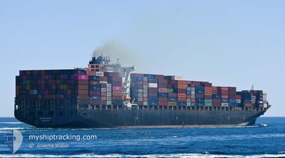
MAERSK SHEKOU
Container Ship
Current Trip
| Time Travelled | 8 days |
|---|---|
| Remaining Time | 3 mins |
| Distance Travelled | 2506.90 nm |
| Remaining Distance | 22.81 nm |
| AVG Speed | 12.3 Knots |
| MAX Speed | 15.6 Knots |
| AVG Wind | 12 knots |
| MAX Wind | 23 knots |
| MIN Temp | 21.9°C / 71.42°F |
| MAX Temp | 29.6°C / 85.28°F |
| Draught | 13 m |
| Position Received | 14 h, 40 m ago |
Current Position
| Longitude | 103.48985° |
|---|---|
| Latitude | 1.22660° |
| Status | Under way using engine |
| Speed | 10.5 Knots |
| Course | 282° |
| Area | Singapore Strait |
| Station | T-AIS |
| Position Received | 14 h, 40 m ago |
Info
Information
The current position of MAERSK SHEKOU is in Singapore Strait with coordinates 1.22660° / 103.48985° as reported on 2024-05-22 03:37 by AIS to our vessel tracker app. The vessel's current speed is 10.5 Knots and is heading at the port of PORT KLANG. The estimated time of arrival as calculated by vessel tracking app is 2024-05-22 18:21 LT
The vessel MAERSK SHEKOU (IMO: 9466984, MMSI: 563165200) is a Container Ship that was built in 2010 ( 14 years old ). It's sailing under the flag of [SG] Singapore.
In this page you can find informations about the vessels current position, last detected port calls, and current voyage information. If the vessels is not in coverage by AIS you will find the latest position.
The current position of MAERSK SHEKOU is detected by our AIS receivers and we are not responsible for the reliability of the data. The last position was recorded while the vessel was in Coverage by the Ais receivers of our vessel tracking app.
The current draught of MAERSK SHEKOU as reported by AIS is 13 meters
Weather
| Temperature | 27.1°C / 80.78°F |
|---|---|
| Wind Speed | 5 knots |
| Direction | 355° N |
| Pressure | 1007.7 hPa |
| Humidity | 86.2 % |
| Cloud Coverage | 100 % |
Featured Company
Last Port Calls
| Port | Arrival | Departure | Time In Port |
|---|---|---|---|
| 2024-05-12 08:38 | 2024-05-14 12:20 | 2 d | |
| 2024-05-06 11:06 | 2024-05-08 00:58 | 1 d | |
| 2024-05-01 10:48 | 2024-05-03 20:54 | 2 d | |
| 2024-04-26 20:59 | 2024-04-29 17:31 | 2 d | |
| 2024-04-16 00:13 | 2024-04-17 01:12 | 1 d | |
| 2024-04-13 20:10 | 2024-04-15 22:47 | 2 d | |
| 2024-04-10 18:55 | 2024-04-11 19:50 | 1 d | |
| 2024-04-07 02:29 | 2024-04-08 07:05 | 1 d | |
| 2024-03-24 02:26 | 2024-03-26 07:32 | 2 d | |
| 2024-03-17 09:41 | 2024-03-19 03:42 | 1 d |
Last Trips
| Origin | Departure | Destination | Arrival | Distance | |
|---|---|---|---|---|---|
| 2024-05-08 10:28 | 2024-05-12 16:38 | 1373.45 nm | |||
| 2024-05-04 06:54 | 2024-05-06 20:36 | 972.39 nm | |||
| 2024-04-30 03:31 | 2024-05-01 20:48 | 584.05 nm | |||
| 2024-04-17 09:12 | 2024-04-27 06:59 | 3958.88 nm | |||
| 2024-04-16 06:47 | 2024-04-16 08:13 | 4.80 nm | |||
| 2024-04-12 03:50 | 2024-04-14 04:10 | 181.10 nm | |||
| 2024-04-08 15:05 | 2024-04-11 02:55 | 207.79 nm | |||
| 2024-03-26 15:32 | 2024-04-07 10:29 | 2550.69 nm | |||
| 2024-03-19 14:12 | 2024-03-24 10:26 | 1380.41 nm | |||
| 2024-03-15 07:51 | 2024-03-17 20:11 | 957.25 nm |
Events
| Time | Event | Details | Position / Dest | Info |
|---|---|---|---|---|
| 2024-05-22 03:44 | Status Changed | Default Under way using engine |
1.23086 / 103.46989
PORT KLANG
|
Speed: 10.5 kn Course: 282° |
| 2024-05-22 03:37 | OUT of Coverage |
1.22660 / 103.48985
Singapore Strait
PORT KLANG
|
Speed: 10.5 kn Course: 282° |
|
| 2024-05-22 03:05 | Change Sea Area | Malaysian part of the Singapore Strait Indonesian part of the Singapore Strait |
1.20337 / 103.58723
Singapore Strait
PORT KLANG
|
Speed: 12.5 kn Course: 291° |
| 2024-05-22 02:29 | Change Sea Area | Indonesian part of the Singapore Strait Singaporean part of the Singapore Strait |
1.16737 / 103.68734
Singapore Strait
PORT KLANG
|
Speed: 10.9 kn Course: 301.7° |
| 2024-05-22 00:44 | Change Sea Area | Singaporean part of the Singapore Strait Indonesian part of the Singapore Strait |
1.25719 / 104.00166
Singapore Strait
PORT KLANG
|
Speed: 13.7 kn Course: 264° |
| 2024-05-22 00:29 | Change Sea Area | Indonesian part of the Singapore Strait Singaporean part of the Singapore Strait |
1.26904 / 104.05172
Singapore Strait
PORT KLANG
|
Speed: 11.6 kn Course: 250.3° |
| 2024-05-22 00:26 | Change Sea Area | Singaporean part of the Singapore Strait Malaysian part of the Singapore Strait |
1.27228 / 104.06079
Singapore Strait
PORT KLANG
|
Speed: 11.4 kn Course: 245.6° |
| 2024-05-21 23:36 | Draught Changed | 13 12.9 |
1.28807 / 104.21968
PORT KLANG
|
Speed: 11.4 kn Course: 260.3° |
| 2024-05-21 23:36 | ETA Changed | 2024/05/23 23:00 2024/05/23 01:00 |
1.28807 / 104.21968
PORT KLANG
|
Speed: 11.4 kn Course: 260.3° |
| 2024-05-21 23:13 | Detected in Sea | Malaysian part of the Singapore Strait |
1.30095 / 104.28783
Singapore Strait
PORT KLANG
|
Speed: 11 kn Course: 259.9° |