
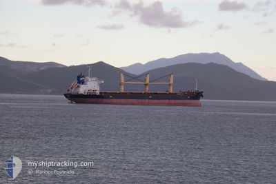
MGD JOY
Bulk Carrier
Current Trip
| Time Travelled | 12 h, 3 mins |
|---|---|
| Remaining Time | --- |
| Distance Travelled | 115.68 nm |
| Remaining Distance | --- |
| AVG Speed | 10 Knots |
| MAX Speed | 11.3 Knots |
| AVG Wind | 14.1 knots |
| MAX Wind | 21.8 knots |
| MIN Temp | 17.3°C / 63.14°F |
| MAX Temp | 22.3°C / 72.14°F |
| Draught | 9.7 m |
| Position Received | 7 h, 20 m ago |
Current Position
| Longitude | -2.14720° |
|---|---|
| Latitude | 36.46838° |
| Status | Under way using engine |
| Speed | 10.5 Knots |
| Course | 218.5° |
| Area | Alboran Sea |
| Station | T-AIS |
| Position Received | 7 h, 20 m ago |
Info
Information
The current position of MGD JOY is in Alboran Sea with coordinates 36.46838° / -2.14720° as reported on 2024-05-21 23:42 by AIS to our vessel tracker app. The vessel's current speed is 10.5 Knots and is heading at the port of TEES. The estimated time of arrival as calculated by vessel tracking app is 2024-05-28 15:00 LT
The vessel MGD JOY (IMO: 9427586, MMSI: 256132000) is a Bulk Carrier that was built in 2011 ( 13 years old ). It's sailing under the flag of [MT] Malta.
In this page you can find informations about the vessels current position, last detected port calls, and current voyage information. If the vessels is not in coverage by AIS you will find the latest position.
The current position of MGD JOY is detected by our AIS receivers and we are not responsible for the reliability of the data. The last position was recorded while the vessel was in Coverage by the Ais receivers of our vessel tracking app.
The current draught of MGD JOY as reported by AIS is 9.7 meters
Weather
| Temperature | 17.5°C / 63.5°F |
|---|---|
| Wind Speed | 14 knots |
| Direction | 278° W |
| Pressure | 1017.7 hPa |
| Humidity | 79.5 % |
| Cloud Coverage | --- |
Featured Company
Last Port Calls
| Port | Arrival | Departure | Time In Port |
|---|---|---|---|
| 2024-05-20 19:18 | 2024-05-21 18:59 | 23 h | |
| 2024-05-12 07:06 | 2024-05-18 10:37 | 6 d | |
| 2024-05-07 05:39 | 2024-05-09 13:52 | 2 d | |
| 2024-04-20 08:51 | 2024-05-01 14:54 | 11 d | |
| 2024-04-15 19:33 | 2024-04-16 23:26 | 1 d | |
| 2024-04-12 07:32 | 2024-04-14 17:00 | 2 d | |
| 2024-04-08 13:01 | 2024-04-11 05:54 | 2 d | |
| 2024-04-01 16:24 | 2024-04-07 05:47 | 5 d | |
| 2024-03-25 14:36 | 2024-03-27 12:07 | 1 d | |
| 2024-03-12 13:40 |
Most Visited Ports (Last year)
| Port | Arrivals | |
|---|---|---|
| 8 | ||
| 4 | ||
| 3 | ||
| 2 | ||
| 2 | ||
| 2 |
Last Trips
| Origin | Departure | Destination | Arrival | Distance | |
|---|---|---|---|---|---|
| 2024-05-18 11:37 | 2024-05-20 21:18 | 142.85 nm | |||
| 2024-05-09 14:52 | 2024-05-12 08:06 | 596.03 nm | |||
| 2024-05-01 15:54 | 2024-05-07 06:39 | 1553.54 nm | |||
| 2024-04-17 01:26 | 2024-04-20 09:51 | 812.12 nm | |||
| 2024-04-14 19:00 | 2024-04-15 21:33 | 340.06 nm | |||
| 2024-04-11 07:54 | 2024-04-12 09:32 | 284.43 nm | |||
| 2024-04-07 05:47 | 2024-04-08 15:01 | 393.60 nm | |||
| 2024-03-27 13:07 | 2024-04-01 16:24 | 760.60 nm | |||
| 2024-03-05 22:08 | 2024-03-12 14:40 | 1742.42 nm | |||
| 2024-02-22 13:24 | 2024-03-03 14:55 | 1362.96 nm |
Events
| Time | Event | Details | Position / Dest | Info |
|---|---|---|---|---|
| 2024-05-21 23:42 | OUT of Coverage |
36.46838 / -2.14720
Alboran Sea
GBTEE
|
Speed: 10.5 kn Course: 218.5° |
|
| 2024-05-21 23:07 | Change Sea Area | Spanish part of the Alboran Sea Spanish part of the Mediterranean Sea - Western Basin |
36.55470 / -2.07546
Alboran Sea
GBTEE
|
Speed: 10.7 kn Course: 213.7° |
| 2024-05-21 21:59 | Status Changed | Under way using engine Default |
36.70901 / -1.93152
GBTEE
|
Speed: 10 kn Course: 217° |
| 2024-05-21 21:55 | Status Changed | Default Under way using engine |
36.71833 / -1.92167
GBTEE
|
Speed: 10 kn Course: 216.1° |
| 2024-05-21 21:49 | Status Changed | Under way using engine Default |
36.73262 / -1.91056
GBTEE
|
Speed: 9 kn Course: 215° |
| 2024-05-21 21:43 | Status Changed | Default Under way using engine |
36.74500 / -1.89833
GBTEE
|
Speed: 9.9 kn Course: 215.3° |
| 2024-05-21 21:38 | Status Changed | Under way using engine Default |
36.75713 / -1.88886
GBTEE
|
Speed: 10.1 kn Course: 216° |
| 2024-05-21 21:17 | Status Changed | Default Under way using engine |
36.80690 / -1.84589
GBTEE
|
Speed: 10.2 kn Course: 215.4° |
| 2024-05-21 21:16 | Status Changed | Under way using engine Default |
36.80966 / -1.84356
GBTEE
|
Speed: 10.3 kn Course: 214° |
| 2024-05-21 20:55 | Status Changed | Default Under way using engine |
36.85968 / -1.80258
GBTEE
|
Speed: 10.2 kn Course: 212.2° |