
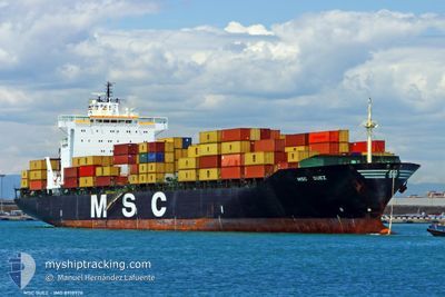
MSC SUEZ
Container Ship
Current Trip
| Time Travelled | 4 days |
|---|---|
| Remaining Time | 1 day |
| Distance Travelled | 720.66 nm |
| Remaining Distance | 903.76 nm |
| AVG Speed | 12.4 Knots |
| MAX Speed | 19.3 Knots |
| AVG Wind | 7.3 knots |
| MAX Wind | 18 knots |
| MIN Temp | 9°C / 48.2°F |
| MAX Temp | 20.3°C / 68.54°F |
| Draught | 10.4 m |
| Position Received | 3 h, 58 m ago |
Current Position
| Longitude | 20.03045° |
|---|---|
| Latitude | 57.43846° |
| Status | Under way using engine |
| Speed | 18.9 Knots |
| Course | 235.1° |
| Area | Baltic Sea |
| Station | T-AIS |
| Position Received | 3 h, 58 m ago |
Info
Information
The current position of MSC SUEZ is in Baltic Sea with coordinates 57.43846° / 20.03045° as reported on 2024-05-22 09:00 by AIS to our vessel tracker app. The vessel's current speed is 18.9 Knots and is heading at the port of ANTWERP. The estimated time of arrival as calculated by vessel tracking app is 2024-05-24 12:09 LT
The vessel MSC SUEZ (IMO: 8918978, MMSI: 355289000) is a Container Ship that was built in 1993 ( 31 years old ). It's sailing under the flag of [PA] Panama.
In this page you can find informations about the vessels current position, last detected port calls, and current voyage information. If the vessels is not in coverage by AIS you will find the latest position.
The current position of MSC SUEZ is detected by our AIS receivers and we are not responsible for the reliability of the data. The last position was recorded while the vessel was in Coverage by the Ais receivers of our vessel tracking app.
The current draught of MSC SUEZ as reported by AIS is 10.4 meters
Weather
| Temperature | 12.1°C / 53.78°F |
|---|---|
| Wind Speed | 15 knots |
| Direction | 68° ENE |
| Pressure | 1018.2 hPa |
| Humidity | 84 % |
| Cloud Coverage | --- |
Featured Company
Last Port Calls
| Port | Arrival | Departure | Time In Port |
|---|---|---|---|
| 2024-05-16 19:23 | 2024-05-18 09:33 | 1 d | |
| 2024-05-09 13:11 | 2024-05-12 04:57 | 2 d | |
| 2024-05-08 09:09 | 2024-05-08 18:44 | 9 h | |
| 2024-05-03 07:08 | 2024-05-04 16:07 | 1 d | |
| 2024-05-01 02:14 | 2024-05-01 11:42 | 9 h | |
| 2024-04-24 08:14 | 2024-04-25 11:42 | 1 d | |
| 2024-04-22 21:35 | 2024-04-23 19:42 | 22 h | |
| 2024-04-16 11:38 | 2024-04-18 01:46 | 1 d | |
| 2024-04-13 21:56 | 2024-04-14 15:36 | 17 h | |
| 2024-04-08 23:52 | 2024-04-10 01:54 | 1 d |
Last Trips
| Origin | Departure | Destination | Arrival | Distance | |
|---|---|---|---|---|---|
| 2024-05-12 06:57 | 2024-05-16 22:23 | 1530.50 nm | |||
| 2024-05-08 20:44 | 2024-05-09 15:11 | 144.37 nm | |||
| 2024-05-04 17:07 | 2024-05-08 11:09 | 1610.51 nm | |||
| 2024-05-01 12:42 | 2024-05-03 08:08 | 345.21 nm | |||
| 2024-04-25 11:42 | 2024-05-01 03:14 | 1860.39 nm | |||
| 2024-04-23 19:42 | 2024-04-24 08:14 | 172.71 nm | |||
| 2024-04-18 01:46 | 2024-04-22 21:35 | 894.43 nm | |||
| 2024-04-14 15:36 | 2024-04-16 11:38 | 482.86 nm | |||
| 2024-04-10 02:54 | 2024-04-13 21:56 | 864.95 nm | |||
| 2024-04-07 17:46 | 2024-04-09 00:52 | 535.85 nm |
Events
| Time | Event | Details | Position / Dest | Info |
|---|---|---|---|---|
| 2024-05-22 09:05 | Status Changed | Default Under way using engine |
57.42584 / 19.99662
BEANR
|
Speed: 18.9 kn Course: 235.1° |
| 2024-05-22 09:00 | Change Sea Area | Swedish part of the Baltic Sea Latvian part of the Baltic Sea |
57.43846 / 20.03045
Baltic Sea
BEANR
|
Speed: 18.9 kn Course: 235.1° |
| 2024-05-22 09:00 | OUT of Coverage |
57.43846 / 20.03045
Baltic Sea
BEANR
|
Speed: 18.9 kn Course: 235.1° |
|
| 2024-05-22 06:16 | Change Sea Area | Latvian part of the Baltic Sea Estonian part of the Baltic Sea |
57.83335 / 21.42420
Baltic Sea
BEANR
|
Speed: 18.5 kn Course: 253.4° |
| 2024-05-22 06:05 | Change Sea Area | Estonian part of the Baltic Sea Latvian part of the Gulf of Riga |
57.85000 / 21.52826
Baltic Sea
BEANR
|
Speed: 18.6 kn Course: 252.3° |
| 2024-05-22 06:04 | Status Changed | Under way using engine Default |
57.85094 / 21.53383
BEANR
|
Speed: 18.5 kn Course: 251° |
| 2024-05-22 05:53 | IN Coverage |
57.85000 / 21.52826
Baltic Sea
BEANR
|
Speed: 18.6 kn Course: 252.3° |
|
| 2024-05-22 03:41 | Status Changed | Default Under way using engine |
57.84734 / 22.63979
BEANR
|
Speed: 18.8 kn Course: 316.7° |
| 2024-05-22 03:34 | OUT of Coverage |
57.82646 / 22.68792
Gulf of Riga
BEANR
|
Speed: 18.8 kn Course: 316.7° |
|
| 2024-05-22 03:23 | Status Changed | Under way using engine Default |
57.78533 / 22.76096
BEANR
|
Speed: 19 kn Course: 316° |