
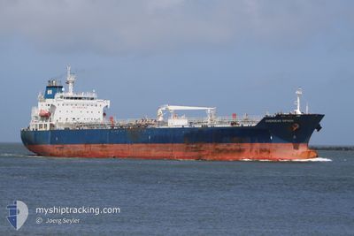
SEAWAYS NANTUCKET
Oil/Chemical Tanker
Current Trip
USCLM>>CLSWE
| Time Travelled | 1 day |
|---|---|
| Remaining Time | --- |
| Distance Travelled | 316.79 nm |
| Remaining Distance | --- |
| AVG Speed | 11 Knots |
| MAX Speed | 12.6 Knots |
| AVG Wind | 20.7 knots |
| MAX Wind | 31.8 knots |
| MIN Temp | 6.5°C / 43.7°F |
| MAX Temp | 11.5°C / 52.7°F |
| Draught | 11.9 m |
| Position Received | 18 h, 34 m ago |
Current Position
| Longitude | -125.22372° |
|---|---|
| Latitude | 48.16399° |
| Status | Under way using engine |
| Speed | 11.6 Knots |
| Course | 186.9° |
| Area | North Pacific Ocean |
| Station | T-AIS |
| Position Received | 18 h, 34 m ago |
Info
Information
The current position of SEAWAYS NANTUCKET is in North Pacific Ocean with coordinates 48.16399° / -125.22372° as reported on 2024-05-17 13:41 by AIS to our vessel tracker app. The vessel's current speed is 11.6 Knots
The vessel SEAWAYS NANTUCKET (IMO: 9384033, MMSI: 538003197) is a Oil/Chemical Tanker that was built in 2008 ( 16 years old ). It's sailing under the flag of [MH] Marshall Is.
In this page you can find informations about the vessels current position, last detected port calls, and current voyage information. If the vessels is not in coverage by AIS you will find the latest position.
The current position of SEAWAYS NANTUCKET is detected by our AIS receivers and we are not responsible for the reliability of the data. The last position was recorded while the vessel was in Coverage by the Ais receivers of our vessel tracking app.
The current draught of SEAWAYS NANTUCKET as reported by AIS is 11.9 meters
Weather
| Temperature | 11.4°C / 52.52°F |
|---|---|
| Wind Speed | 18 knots |
| Direction | 355° N |
| Pressure | 1021.5 hPa |
| Humidity | 71.8 % |
| Cloud Coverage | 18 % |
Featured Company
Last Port Calls
| Port | Arrival | Departure | Time In Port |
|---|---|---|---|
| 2024-05-16 18:50 | 2024-05-17 04:09 | 9 h | |
| 2024-05-15 02:13 | 2024-05-16 13:38 | 1 d | |
| 2024-04-11 23:42 | 2024-04-30 23:49 | 19 d | |
| 2024-04-10 22:47 | 2024-04-11 10:44 | 11 h | |
| 2024-04-01 05:33 | 2024-04-05 00:06 | 3 d | |
| 2024-03-29 07:01 | 2024-03-30 02:45 | 19 h | |
| 2024-03-26 23:00 | 2024-03-27 22:39 | 23 h | |
| 2024-03-18 22:03 | 2024-03-23 17:08 | 4 d |
Most Visited Ports (Last year)
| Port | Arrivals | |
|---|---|---|
| 3 | ||
| 2 | ||
| 1 | ||
| 1 | ||
| 1 | ||
| 1 |
Last Trips
| Origin | Departure | Destination | Arrival | Distance | |
|---|---|---|---|---|---|
| 2024-05-16 06:38 | 2024-05-16 11:50 | 57.67 nm | |||
| 2024-04-30 18:49 | 2024-05-14 19:13 | 2688.30 nm | |||
| 2024-04-11 05:44 | 2024-04-11 18:42 | 158.18 nm | |||
| 2024-04-04 18:06 | 2024-04-10 17:47 | 188.83 nm | |||
| 2024-03-29 19:45 | 2024-03-31 23:33 | 660.98 nm | |||
| 2024-03-27 15:39 | 2024-03-29 00:01 | 389.25 nm | |||
| 2024-03-23 11:08 | 2024-03-26 16:00 | 344.69 nm | |||
| 2024-02-26 06:17 | 2024-03-18 16:03 | 3356.09 nm |
Events
| Time | Event | Details | Position / Dest | Info |
|---|---|---|---|---|
| 2024-05-17 22:57 | ETA Changed | 2024/06/06 12:00 2024/06/06 11:00 |
46.31124 / -125.28150
USCLM>>CLSWE
|
Speed: 12.3 kn Course: 182° |
| 2024-05-17 13:46 | Status Changed | Default Under way using engine |
48.14833 / -125.22558
USCLM>>CLSWE
|
Speed: 11.6 kn Course: 186.9° |
| 2024-05-17 13:41 | OUT of Coverage |
48.16399 / -125.22372
North Pacific Ocean
USCLM>>CLSWE
|
Speed: 11.6 kn Course: 186.9° |
|
| 2024-05-17 13:35 | Status Changed | Under way using engine Default |
48.18418 / -125.22128
USCLM>>CLSWE
|
Speed: 11.3 kn Course: 184° |
| 2024-05-17 13:30 | Status Changed | Default Under way using engine |
48.19825 / -125.21931
USCLM>>CLSWE
|
Speed: 11.2 kn Course: 187° |
| 2024-05-17 13:20 | Status Changed | Under way using engine Default |
48.23002 / -125.21364
USCLM>>CLSWE
|
Speed: 11.3 kn Course: 189° |
| 2024-05-17 13:18 | Status Changed | Default Under way using engine |
48.23589 / -125.21254
USCLM>>CLSWE
|
Speed: 11.1 kn Course: 189.1° |
| 2024-05-17 13:13 | Change Sea Area | United States part of the North Pacific Ocean Canadian part of the The Coastal Waters of Southeast Alaska and British Columbia |
48.25204 / -125.20960
North Pacific Ocean
USCLM>>CLSWE
|
Speed: 11.1 kn Course: 189.1° |
| 2024-05-17 13:11 | Status Changed | Under way using engine Default |
48.25864 / -125.20824
USCLM>>CLSWE
|
Speed: 11 kn Course: 184° |
| 2024-05-17 13:10 | IN Coverage |
48.25204 / -125.20960
North Pacific Ocean
USCLM>>CLSWE
|
Speed: 11.1 kn Course: 189.1° |