
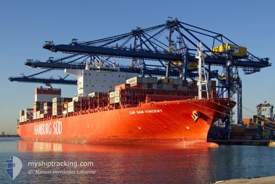
CAP SAN VINCENT
Cargo A
Current Trip
| Time Travelled | 17 days |
|---|---|
| Remaining Time | --- |
| Distance Travelled | 7185.31 nm |
| Remaining Distance | --- |
| AVG Speed | 16.9 Knots |
| MAX Speed | 21 Knots |
| AVG Wind | 13.6 knots |
| MAX Wind | 36 knots |
| MIN Temp | 15.1°C / 59.18°F |
| MAX Temp | 30.3°C / 86.54°F |
| Draught | 14.7 m |
| Position Received | 5 d ago |
Current Position
| Longitude | 17.83477° |
|---|---|
| Latitude | -34.42910° |
| Status | Under way using engine |
| Speed | 18.2 Knots |
| Course | 317.2° |
| Area | South Atlantic Ocean |
| Station | T-AIS |
| Position Received | 5 d ago |
Info
Information
The current position of CAP SAN VINCENT is in South Atlantic Ocean with coordinates -34.42910° / 17.83477° as reported on 2024-06-04 13:52 by AIS to our vessel tracker app. The vessel's current speed is 18.2 Knots and is heading at the port of TANGER MED. The estimated time of arrival as calculated by vessel tracking app is 2024-06-16 06:00 LT
The vessel CAP SAN VINCENT (IMO: 9717228, MMSI: 538008133) is a Cargo A It's sailing under the flag of [MH] Marshall Is.
In this page you can find informations about the vessels current position, last detected port calls, and current voyage information. If the vessels is not in coverage by AIS you will find the latest position.
The current position of CAP SAN VINCENT is detected by our AIS receivers and we are not responsible for the reliability of the data. The last position was recorded while the vessel was in Coverage by the Ais receivers of our vessel tracking app.
The current draught of CAP SAN VINCENT as reported by AIS is 14.7 meters
Weather
| Temperature | 24.7°C / 76.46°F |
|---|---|
| Wind Speed | 7 knots |
| Direction | 129° SE |
| Pressure | 1016.2 hPa |
| Humidity | 80.5 % |
| Cloud Coverage | 36 % |
Featured Company
Last Port Calls
Most Visited Ports (Last year)
| Port | Arrivals | |
|---|---|---|
| 11 | ||
| 10 | ||
| 8 | ||
| 7 | ||
| 6 | ||
| 6 |
Last Trips
| Origin | Departure | Destination | Arrival | Distance | |
|---|---|---|---|---|---|
| 2024-05-20 20:54 | 2024-05-22 20:46 | 431.39 nm | |||
| 2024-05-17 10:32 | 2024-05-19 23:26 | 985.75 nm | |||
| 2024-05-12 00:43 | 2024-05-15 01:01 | 1006.70 nm | |||
| 2024-04-14 22:50 | 2024-05-08 22:13 | 9551.51 nm | |||
| 2024-03-19 17:58 | 2024-04-14 02:03 | 9906.67 nm |
Events
| Time | Event | Details | Position / Dest | Info |
|---|---|---|---|---|
| 2024-06-04 13:57 | Status Changed | Default Under way using engine |
-34.40978 / 17.81123
TANGER MED 2
|
Speed: 18.2 kn Course: 317.2° |
| 2024-06-04 13:52 | Status Changed | Under way using engine Default |
-34.42910 / 17.83477
TANGER MED 2
|
Speed: 18 kn Course: 314° |
| 2024-06-04 13:52 | OUT of Coverage |
-34.42910 / 17.83477
South Atlantic Ocean
TANGER MED 2
|
Speed: 18.2 kn Course: 317.2° |
|
| 2024-06-04 13:46 | IN Coverage |
-34.42910 / 17.83477
South Atlantic Ocean
TANGER MED 2
|
Speed: 18.2 kn Course: 317.2° |
|
| 2024-06-04 12:54 | Status Changed | Default Under way using engine |
-34.53103 / 18.15485
TANGER MED 2
|
Speed: 18.4 kn Course: 294.2° |
| 2024-06-04 12:50 | OUT of Coverage |
-34.53925 / 18.17677
South Atlantic Ocean
TANGER MED 2
|
Speed: 18.4 kn Course: 294.2° |
|
| 2024-06-04 11:28 | Status Changed | Under way using engine Default |
-34.69498 / 18.63218
TANGER MED 2
|
Speed: 17.7 kn Course: 289° |
| 2024-06-04 11:22 | Status Changed | Default Under way using engine |
-34.70588 / 18.66328
TANGER MED 2
|
Speed: 17.7 kn Course: 291.1° |
| 2024-06-04 11:16 | Status Changed | Under way using engine Default |
-34.71683 / 18.69400
TANGER MED 2
|
Speed: 17.5 kn Course: 295° |
| 2024-06-04 11:02 | Status Changed | Default Under way using engine |
-34.74497 / 18.77360
TANGER MED 2
|
Speed: 17.1 kn Course: 294.3° |