
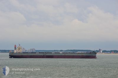
CAPE VALENCIA
Bulk Carrier
Current Trip
| Time Travelled | 3 h, 54 mins |
|---|---|
| Remaining Time | --- |
| Distance Travelled | --- |
| Remaining Distance | --- |
| AVG Speed | --- |
| MAX Speed | --- |
| AVG Wind | --- |
| MAX Wind | --- |
| MIN Temp | --- |
| MAX Temp | --- |
| Draught | 17.5 m |
| Position Received | 21 d ago |
Current Position
| Longitude | 57.30053° |
|---|---|
| Latitude | 24.91724° |
| Status | Under way using engine |
| Speed | 11.8 Knots |
| Course | 129.5° |
| Area | Gulf of Oman |
| Station | T-AIS |
| Position Received | 21 d ago |
Info
Information
The current position of CAPE VALENCIA is in Gulf of Oman with coordinates 24.91724° / 57.30053° as reported on 2024-05-18 08:57 by AIS to our vessel tracker app. The vessel's current speed is 11.8 Knots
The vessel CAPE VALENCIA (IMO: 9578684, MMSI: 373498000) is a Bulk Carrier that was built in 2012 ( 12 years old ). It's sailing under the flag of [PA] Panama.
In this page you can find informations about the vessels current position, last detected port calls, and current voyage information. If the vessels is not in coverage by AIS you will find the latest position.
The current position of CAPE VALENCIA is detected by our AIS receivers and we are not responsible for the reliability of the data. The last position was recorded while the vessel was in Coverage by the Ais receivers of our vessel tracking app.
The current draught of CAPE VALENCIA as reported by AIS is 17.5 meters
Weather
| Temperature | 29.3°C / 84.74°F |
|---|---|
| Wind Speed | 18 knots |
| Direction | 220° SW |
| Pressure | 1005.3 hPa |
| Humidity | 85.9 % |
| Cloud Coverage | 60 % |
Featured Company
Last Port Calls
| Port | Arrival | Departure | Time In Port |
|---|---|---|---|
| 2024-06-02 22:37 | 2024-06-08 12:44 | 5 d | |
| 2024-05-27 08:47 | 2024-05-31 06:36 | 3 d | |
| 2024-05-12 21:37 | 2024-05-17 00:26 | 4 d | |
| 2024-04-24 12:09 | 2024-04-30 11:24 | 5 d | |
| 2024-04-07 17:55 | 2024-04-12 19:26 | 5 d |
Most Visited Ports (Last year)
| Port | Arrivals | |
|---|---|---|
| 9 | ||
| 8 | ||
| 6 | ||
| 5 | ||
| 3 | ||
| 1 |
Last Trips
| Origin | Departure | Destination | Arrival | Distance | |
|---|---|---|---|---|---|
| 2024-05-31 12:06 | 2024-06-03 04:07 | 304.51 nm | |||
| 2024-05-17 04:26 | 2024-05-27 14:17 | 2645.72 nm | |||
| 2024-04-30 16:54 | 2024-05-13 01:37 | 2738.88 nm | |||
| 2024-04-12 23:26 | 2024-04-24 17:39 | 2691.00 nm | |||
| 2024-03-29 12:26 | 2024-04-07 21:55 | 1265.95 nm |
Events
| Time | Event | Details | Position / Dest | Info |
|---|---|---|---|---|
| 2024-06-08 12:44 | PORT DEPARTURE |
|
17.68649 / 83.33046
INKRI
|
Speed: 2.9 kn Course: 95° |
| 2024-06-02 23:08 | STOP Moving |
17.69245 / 83.29764
[IN] VISAKHAPATNAM
|
Speed: 0.1 kn Course: 131° |
|
| 2024-06-02 22:37 | PORT ARRIVAL |
|
17.68615 / 83.30513
[IN] VISAKHAPATNAM
|
Speed: 3 kn Course: 260° |
| 2024-06-02 20:56 | START Moving | 8.31 nm, South East of VISAKHAPATNAM |
17.62883 / 83.43504
INKRI
|
Speed: 4.4 kn Course: 270° |
| 2024-06-02 04:54 | STOP Moving | 8.6 nm, South East of VISAKHAPATNAM |
17.62872 / 83.44057
INKRI
|
Speed: 0.3 kn Course: 235° |
| 2024-06-01 04:23 | STOP Moving |
15.86623 / 82.50650
INKRI
|
Speed: 0.2 kn Course: 114° |
|
| 2024-05-31 06:57 | START Moving | 2.78 nm, East of KRISHNAPATNAM |
14.25255 / 80.18940
INKRI
|
Speed: 10.2 kn Course: 85° |
| 2024-05-31 06:36 | PORT DEPARTURE |
|
14.25255 / 80.18940
INKRI
|
Speed: 1.7 kn Course: 99° |