
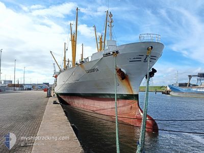
CASSIOPEA
Reefer
Aktuelle Reise
| Bisherige Reisezeit | 14 Tage |
|---|---|
| Verbleibende Reisezeit | 18 h, 9 Minuten |
| Zurückgelegte Distanz | 1421.97 nm |
| Verbleibende Distanz | 248.63 nm |
| Durchschnittliche Geschwindigkeit | 12.6 Knoten |
| Maximale Geschwindigkeit | 15.7 Knoten |
| Durchschnittliche Windgeschwindigkeit | 10.9 Knoten |
| Maximale Windgeschwindigkeit | 22.2 Knoten |
| Minimale Temperatur | 19.8°C / 67.64°F |
| Maximale Temperatur | 28.4°C / 83.12°F |
| Tiefgang | 6.9 m |
| Position erhalten | 1 d alt |
Aktuelle Position
| Länge | --- |
|---|---|
| Breite | --- |
| Zustand | Under way using engine |
| Geschwindigkeit | 13.4 Knoten |
| Kurs | 177° |
| Gebiet | North Atlantic Ocean |
| Station | T-AIS |
| Position erhalten | 1 d alt |
Schiffsdetails
Information
Die CASSIOPEA befindet sich derzeit in North Atlantic Ocean mit den Koordinaten 14.02417° / -17.88817°, Diese Position wurde am 2024-10-20 20:31 von unserer Schiffsverfolgungs-App über AIS erfasst. Das Schiff fährt momentan mit einer Geschwindigkeit von 13.4 Knoten und fahrt in den Hafen von MONROVIA. Die geschatzte Ankunftszeit, berechnet von der -App zur Schiffsverfolgung, ist 2024-10-23 01:58 LT
Das Schiff CASSIOPEA (IMO: 9047269, MMSI: 277397000) ist Reefer das wurde im Jahr 1993 ( 31 Jahre alt ) gebaut. und fährt unter der Flagge von [LT] Lithuania.
Auf dieser Seite erhalten Sie Informationen zur aktuellen Position des Schiffes, zu den letzten bekannten Hafenanläufen und zu den aktuellen Reiseinformationen. Sollte das Schiff nicht durch AIS abgedeckt sein, wird die zuletzt erfasste Position angezeigt.
Die CASSIOPEA wird durch unsere AIS-Empfänger ermittelt. Wir übernehmen keine Gewähr für die Richtigkeit der Daten. Die letzte Position wurde von unseren AIS-Empfängern aufgezeichnet, während das Schiff in Reichweite war.
Der aktuelle Entwurf von CASSIOPEA, wie von AIS gemeldet, betragt 6.9 meter
Wetter
| Temperatur | 27.1°C / 80.78°F |
|---|---|
| Windgeschwindigkeit | 5 Knoten |
| Windrichtung | 263° W |
| Luftdruck | 1012.2 hPa |
| Luftfeuchtigkeit | 79.3 % |
| Wolken | 15 % |
Featured Company
Letzte Hafenanläufe
| Hafen | Ankunft | Abfahrt | Time In Port |
|---|---|---|---|
| 2024-10-06 23:10 | 2024-10-07 16:02 | 16 h | |
| 2024-09-10 09:28 | 2024-09-20 05:49 | 9 d | |
| 2024-08-25 09:41 | 2024-08-31 02:49 | 5 d | |
| 2024-08-06 04:57 |
Meistbesuchte Häfen (Letztes Jahr)
| Hafen | Ankünfte | |
|---|---|---|
| 3 | ||
| 2 | ||
| 2 | ||
| 2 | ||
| 1 | ||
| 1 |
Letzte Reisen
| Herkunft | Abfahrt | Ziel | Ankunft | Distanz | |
|---|---|---|---|---|---|
| 2024-09-20 06:49 | 2024-10-07 00:10 | 3193.42 nm | |||
| 2024-08-31 03:49 | 2024-09-10 10:28 | 48.13 nm | |||
| 2024-08-06 01:57 | 2024-08-25 10:41 | 4478.30 nm |
Events
| Zeit | Ereignis | Details | Position / Ziel | Information |
|---|---|---|---|---|
| 2024-10-20 20:35 | geänderter Status | Default Under way using engine |
14.00677 / -17.88643
MONROVIA
|
Geschwindigkeit: 13.4 kn Kurs: 177° |
| 2024-10-20 20:31 | außerhalb Abdeckung |
14.02417 / -17.88817
North Atlantic Ocean
MONROVIA
|
Geschwindigkeit: 13.4 kn Kurs: 177° |
|
| 2024-10-20 20:28 | geänderter Status | Under way using engine Default |
14.03507 / -17.88917
MONROVIA
|
Geschwindigkeit: 13.1 kn Kurs: 173° |
| 2024-10-20 20:19 | in Abdeckung |
14.03140 / -17.88875
North Atlantic Ocean
MONROVIA
|
Geschwindigkeit: 13.2 kn Kurs: 172° |
|
| 2024-10-20 19:11 | geänderter Status | Default Under way using engine |
14.32262 / -17.88368
MONROVIA
|
Geschwindigkeit: 13.1 kn Kurs: 183° |
| 2024-10-20 19:05 | Ändere Seegebiet | Senegalese part of the North Atlantic Ocean Mauritanian part of the North Atlantic Ocean |
14.34807 / -17.88257
North Atlantic Ocean
MONROVIA
|
Geschwindigkeit: 13.1 kn Kurs: 183° |
| 2024-10-20 19:05 | geänderter Status | Under way using engine Default |
14.34807 / -17.88257
MONROVIA
|
Geschwindigkeit: 13.2 kn Kurs: 178° |
| 2024-10-20 19:05 | außerhalb Abdeckung |
14.34807 / -17.88257
North Atlantic Ocean
MONROVIA
|
Geschwindigkeit: 13.1 kn Kurs: 183° |
|
| 2024-10-20 18:51 | in Abdeckung |
14.34807 / -17.88257
North Atlantic Ocean
MONROVIA
|
Geschwindigkeit: 13.1 kn Kurs: 183° |
|
| 2024-10-20 09:22 | außerhalb Abdeckung |
16.54990 / -17.88308
North Atlantic Ocean
MONROVIA
|
Geschwindigkeit: 14 kn Kurs: 179° |