
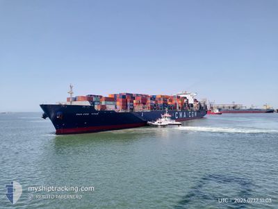
CMA CGM TITUS
Container Ship
Current Trip
| Trip Time | 5 days |
|---|---|
| Trip Distance | 1375.38 nm |
| AVG Speed | 13.7 Knots |
| MAX Speed | 17.9 Knots |
| Draught | 13 m |
| AVG Wind | 8.5 knots |
| MAX Wind | 20.3 knots |
| MIN Temp | 27.8°C / 82.04°F |
| MAX Temp | 34.3°C / 93.74°F |
| Position Received | 4 d ago |
Current Position
| Longitude | 57.35611° |
|---|---|
| Latitude | 25.25851° |
| Status | Under way using engine |
| Speed | 16.2 Knots |
| Course | 118.5° |
| Area | Gulf of Oman |
| Station | T-AIS |
| Position Received | 4 d ago |
Info
Information
The current position of CMA CGM TITUS is in Gulf of Oman with coordinates 25.25851° / 57.35611° as reported on 2024-06-22 05:43 by AIS to our vessel tracker app. The vessel's current speed is 16.2 Knots and is currently inside the port of NHAVA SHEVA.
The vessel CMA CGM TITUS (IMO: 9450636, MMSI: 228368900) is a Container Ship that was built in 2011 ( 13 years old ). It's sailing under the flag of [FR] France.
In this page you can find informations about the vessels current position, last detected port calls, and current voyage information. If the vessels is not in coverage by AIS you will find the latest position.
The current position of CMA CGM TITUS is detected by our AIS receivers and we are not responsible for the reliability of the data. The last position was recorded while the vessel was in Coverage by the Ais receivers of our vessel tracking app.
The current draught of CMA CGM TITUS as reported by AIS is 13 meters
Weather
| Temperature | 28°C / 82.4°F |
|---|---|
| Wind Speed | 16 knots |
| Direction | 202° SSW |
| Pressure | 998.6 hPa |
| Humidity | 88.2 % |
| Cloud Coverage | 100 % |
Featured Company
Last Port Calls
| Port | Arrival | Departure | Time In Port |
|---|---|---|---|
| 2024-06-26 04:17 | |||
| 2024-06-18 07:45 | 2024-06-20 10:53 | 2 d | |
| 2024-05-22 01:24 | 2024-05-22 23:30 | 22 h | |
| 2024-05-18 19:00 | 2024-05-19 18:30 | 23 h | |
| 2024-05-16 21:32 | 2024-05-18 04:13 | 1 d | |
| 2024-05-12 14:37 | 2024-05-14 21:22 | 2 d | |
| 2024-05-06 12:39 | 2024-05-09 08:16 | 2 d | |
| 2024-04-30 21:02 | 2024-05-02 19:44 | 1 d | |
| 2024-04-26 11:06 | 2024-04-27 06:51 | 19 h |
Last Trips
| Origin | Departure | Destination | Arrival | Distance | |
|---|---|---|---|---|---|
| 2024-06-20 14:53 | 2024-06-26 09:47 | 1375.38 nm | |||
| 2024-05-23 01:30 | 2024-06-18 11:45 | 10381.27 nm | |||
| 2024-05-19 20:30 | 2024-05-22 03:24 | 180.17 nm | |||
| 2024-05-18 06:13 | 2024-05-18 21:00 | 192.91 nm | |||
| 2024-05-14 23:22 | 2024-05-16 23:32 | 260.49 nm | |||
| 2024-05-09 10:16 | 2024-05-12 16:37 | 661.10 nm | |||
| 2024-05-02 22:44 | 2024-05-06 14:39 | 595.59 nm | |||
| 2024-04-27 08:51 | 2024-05-01 00:02 | 1288.86 nm | |||
| 2024-03-31 19:07 | 2024-04-26 13:06 | 10232.82 nm |
Events
| Time | Event | Details | Position / Dest | Info |
|---|---|---|---|---|
| 2024-06-26 04:17 | STOP Moving |
18.94846 / 72.94055
[IN] NHAVA SHEVA
|
Speed: 0.3 kn Course: 219° |
|
| 2024-06-26 04:17 | PORT ARRIVAL |
|
18.94846 / 72.94055
[IN] NHAVA SHEVA
|
Speed: 1.6 kn Course: 182° |
| 2024-06-24 13:59 | START Moving | 1.11 nm, East of SALEHAABAD ISLAND |
24.80250 / 66.98985
AEJEA >> PKKHI
|
Speed: 4.1 kn Course: 152° |
| 2024-06-23 19:11 | STOP Moving | 1.14 nm, East of SALEHAABAD ISLAND |
24.79907 / 66.98951
AEJEA >> PKKHI
|
Speed: 0.1 kn Course: 331° |
| 2024-06-23 17:30 | START Moving | 8.74 nm, South West of SALEHAABAD ISLAND |
24.68404 / 66.87981
AEJEA >> PKKHI
|
Speed: 8.9 kn Course: 72° |
| 2024-06-23 17:18 | STOP Moving | 8.96 nm, South West of SALEHAABAD ISLAND |
24.68991 / 66.86481
AEJEA >> PKKHI
|
Speed: 0.3 kn Course: 150° |
| 2024-06-22 05:49 | Status Changed | Default Under way using engine |
25.24439 / 57.38489
AEJEA >> PKKHI
|
Speed: 16.2 kn Course: 118.5° |
| 2024-06-22 05:43 | OUT of Coverage |
25.25851 / 57.35611
Gulf of Oman
AEJEA >> PKKHI
|
Speed: 16.2 kn Course: 118.5° |
|
| 2024-06-22 03:56 | Change Sea Area | Iranian part of the Gulf of Oman United Arab Emirates part of the Gulf of Oman |
25.49071 / 56.90026
Gulf of Oman
AEJEA >> PKKHI
|
Speed: 15.7 kn Course: 136.5° |
| 2024-06-22 03:14 | Change Sea Area | United Arab Emirates part of the Gulf of Oman Omani part of the Gulf of Oman |
25.65938 / 56.81405
Gulf of Oman
AEJEA >> PKKHI
|
Speed: 16.5 kn Course: 166.5° |