
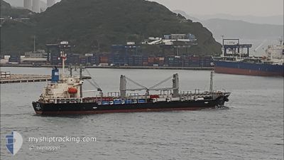
COREBEST OL
General Cargo
Current Trip
| Time Travelled | 3 days |
|---|---|
| Remaining Time | --- |
| Distance Travelled | 687.84 nm |
| Remaining Distance | --- |
| AVG Speed | 11.5 Knots |
| MAX Speed | 14.1 Knots |
| AVG Wind | 12.3 knots |
| MAX Wind | 16 knots |
| MIN Temp | 24.7°C / 76.46°F |
| MAX Temp | 29°C / 84.2°F |
| Draught | 5 m |
| Position Received | 3 d ago |
Current Position
| Longitude | -44.29065° |
|---|---|
| Latitude | -2.43453° |
| Status | At anchor |
| Speed | 0.1 Knots |
| Course | 43° |
| Area | South Atlantic Ocean |
| Station | T-AIS |
| Position Received | 3 d ago |
Info
Information
The current position of COREBEST OL is in South Atlantic Ocean with coordinates -2.43453° / -44.29065° as reported on 2024-05-30 15:17 by AIS to our vessel tracker app. The vessel's current speed is 0.1 Knots and is heading at the port of TERNEUZEN. The estimated time of arrival as calculated by vessel tracking app is 2024-05-27 15:44 LT
The vessel COREBEST OL (IMO: 9651943, MMSI: 373841000) is a General Cargo that was built in 2012 ( 12 years old ). It's sailing under the flag of [PA] Panama.
In this page you can find informations about the vessels current position, last detected port calls, and current voyage information. If the vessels is not in coverage by AIS you will find the latest position.
The current position of COREBEST OL is detected by our AIS receivers and we are not responsible for the reliability of the data. The last position was recorded while the vessel was in Coverage by the Ais receivers of our vessel tracking app.
The current draught of COREBEST OL as reported by AIS is 5 meters
Weather
| Temperature | 28°C / 82.4°F |
|---|---|
| Wind Speed | 12 knots |
| Direction | 103° ESE |
| Pressure | 1012.8 hPa |
| Humidity | 81 % |
| Cloud Coverage | 98 % |
Featured Company
Last Port Calls
| Port | Arrival | Departure | Time In Port |
|---|---|---|---|
| 2024-05-27 19:59 | 2024-05-29 22:42 | 2 d | |
| 2024-05-12 04:21 | 2024-05-16 00:25 | 3 d | |
| 2024-04-17 09:22 | 2024-04-22 22:38 | 5 d |
Most Visited Ports (Last year)
| Port | Arrivals | |
|---|---|---|
| 3 | ||
| 1 | ||
| 1 | ||
| 1 | ||
| 1 | ||
| 1 |
Last Trips
| Origin | Departure | Destination | Arrival | Distance | |
|---|---|---|---|---|---|
| 2024-05-15 21:25 | 2024-05-27 16:59 | 2933.04 nm | |||
| 2024-04-22 23:38 | 2024-05-12 01:21 | 4419.03 nm | |||
| 2024-03-14 06:42 | 2024-04-17 10:22 | 4570.16 nm |
Events
| Time | Event | Details | Position / Dest | Info |
|---|---|---|---|---|
| 2024-05-31 13:34 | START Moving | 5.49 nm, North of SAO LUIS |
-2.43114 / -44.28923
FOR ORDER
|
Speed: 4.6 kn Course: 6° |
| 2024-05-30 15:18 | Status Changed | Default At anchor |
-2.43453 / -44.29065
FOR ORDER
|
Speed: 0.1 kn Course: 43° |
| 2024-05-30 15:17 | OUT of Coverage |
-2.43453 / -44.29065
South Atlantic Ocean
|
Speed: 0.1 kn Course: 233.3° |
|
| 2024-05-30 15:06 | Draught Changed | 5 7.6 |
-2.43444 / -44.29075
FOR ORDER
|
Speed: 0.1 kn Course: 48° |
| 2024-05-30 15:06 | Destination Changed | FOR ORDER BR ITQ |
-2.43444 / -44.29075
FOR ORDER
|
Speed: 0.1 kn Course: 48° |
| 2024-05-30 15:06 | ETA Changed | 2024/05/27 15:44 2024/05/27 12:00 |
-2.43444 / -44.29075
FOR ORDER
|
Speed: 0.1 kn Course: 48° |
| 2024-05-30 14:50 | Detected in Sea | Brazilian part of the South Atlantic Ocean |
-2.43439 / -44.29071
South Atlantic Ocean
|
Speed: 0.2 kn Course: 130.4° |
| 2024-05-30 14:50 | Status Changed | At anchor Default |
-2.43439 / -44.29071
BR ITQ
|
Speed: 0.2 kn Course: 51° |
| 2024-05-30 14:50 | IN Coverage |
-2.43439 / -44.29071
South Atlantic Ocean
|
Speed: 0.2 kn Course: 130.4° |
|
| 2024-05-30 00:59 | STOP Moving | 5.28 nm, North of SAO LUIS |
-2.43443 / -44.29075
BR ITQ
|
Speed: 0.2 kn Course: 46° |