
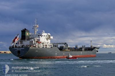
ELISABETH SCHULTE
Oil/Chemical Tanker
Current Trip
MUPLU
| Time Travelled | 32 days |
|---|---|
| Remaining Time | --- |
| Distance Travelled | 9149.56 nm |
| Remaining Distance | --- |
| AVG Speed | 11.7 Knots |
| MAX Speed | 14.4 Knots |
| AVG Wind | 12.8 knots |
| MAX Wind | 27 knots |
| MIN Temp | 15°C / 59°F |
| MAX Temp | 31.9°C / 89.42°F |
| Draught | 9.3 m |
| Position Received | 2 d ago |
Current Position
| Longitude | 4.36403° |
|---|---|
| Latitude | -18.53056° |
| Status | Under way using engine |
| Speed | 13 Knots |
| Course | 322.7° |
| Area | South Atlantic Ocean |
| Station | T-AIS |
| Position Received | 2 d ago |
Info
Information
The current position of ELISABETH SCHULTE is in South Atlantic Ocean with coordinates -18.53056° / 4.36403° as reported on 2024-05-17 14:34 by AIS to our vessel tracker app. The vessel's current speed is 13 Knots
The vessel ELISABETH SCHULTE (IMO: 9439840, MMSI: 235076265) is a Oil/Chemical Tanker that was built in 2010 ( 14 years old ). It's sailing under the flag of [GB] United Kingdom.
In this page you can find informations about the vessels current position, last detected port calls, and current voyage information. If the vessels is not in coverage by AIS you will find the latest position.
The current position of ELISABETH SCHULTE is detected by our AIS receivers and we are not responsible for the reliability of the data. The last position was recorded while the vessel was in Coverage by the Ais receivers of our vessel tracking app.
The current draught of ELISABETH SCHULTE as reported by AIS is 9.3 meters
Weather
| Temperature | 26.4°C / 79.52°F |
|---|---|
| Wind Speed | 13 knots |
| Direction | 141° SE |
| Pressure | 1012.7 hPa |
| Humidity | 74.3 % |
| Cloud Coverage | 17 % |
Featured Company
Last Port Calls
| Port | Arrival | Departure | Time In Port |
|---|---|---|---|
| 2024-04-16 02:46 | 2024-04-18 03:25 | 2 d | |
| 2024-03-12 23:56 | 2024-03-13 14:33 | 14 h | |
| 2024-03-04 04:51 | 2024-03-09 20:08 | 5 d |
Last Trips
| Origin | Departure | Destination | Arrival | Distance | |
|---|---|---|---|---|---|
| 2024-03-13 07:33 | 2024-04-16 10:46 | 7864.70 nm | |||
| 2024-03-09 12:08 | 2024-03-12 16:56 | 532.10 nm | |||
| 2024-01-31 00:04 | 2024-03-03 20:51 | 7949.47 nm |
Events
| Time | Event | Details | Position / Dest | Info |
|---|---|---|---|---|
| 2024-05-17 14:39 | Status Changed | Default Under way using engine |
-18.51500 / 4.35167
MUPLU
|
Speed: 13 kn Course: 322.7° |
| 2024-05-17 14:34 | Change Sea Area | High seas of the South Atlantic Ocean South African part of the South Atlantic Ocean |
-18.53056 / 4.36403
South Atlantic Ocean
|
Speed: 13 kn Course: 322.7° |
| 2024-05-17 14:34 | Status Changed | Under way using engine Default |
-18.53056 / 4.36403
MUPLU
|
Speed: 13 kn Course: 323° |
| 2024-05-17 14:34 | OUT of Coverage |
-18.53056 / 4.36403
South Atlantic Ocean
|
Speed: 13 kn Course: 322.7° |
|
| 2024-05-17 14:15 | IN Coverage |
-18.53056 / 4.36403
South Atlantic Ocean
|
Speed: 13 kn Course: 322.7° |
|
| 2024-05-14 16:06 | Status Changed | Default Under way using engine |
-30.58500 / 14.61333
MUPLU
|
Speed: 13 kn Course: 323.7° |
| 2024-05-14 16:01 | Status Changed | Under way using engine Default |
-30.60003 / 14.62606
MUPLU
|
Speed: 13.1 kn Course: 323° |
| 2024-05-14 16:01 | IN Coverage |
-30.60003 / 14.62606
South Atlantic Ocean
|
Speed: 13 kn Course: 323.7° |
|
| 2024-05-14 16:01 | OUT of Coverage |
-30.60003 / 14.62606
South Atlantic Ocean
|
Speed: 13 kn Course: 323.7° |
|
| 2024-05-14 00:40 | OUT of Coverage |
-33.21754 / 16.95156
South Atlantic Ocean
|
Speed: 12.3 kn Course: 322.4° |