
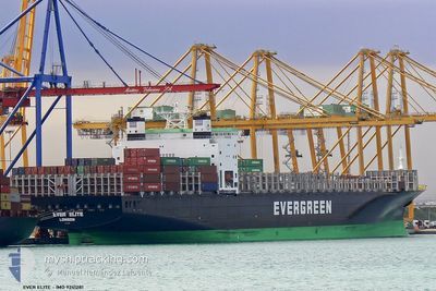
EVER ELITE
Container Ship
Current Trip
| Time Travelled | 8 days |
|---|---|
| Remaining Time | 1 day |
| Distance Travelled | 3342.91 nm |
| Remaining Distance | 707.90 nm |
| AVG Speed | 15.5 Knots |
| MAX Speed | 19.3 Knots |
| AVG Wind | 13.4 knots |
| MAX Wind | 22.9 knots |
| MIN Temp | 24.9°C / 76.82°F |
| MAX Temp | 30.6°C / 87.08°F |
| Draught | 13.5 m |
| Position Received | 10 h, 6 m ago |
Current Position
| Longitude | 76.56243° |
|---|---|
| Latitude | 8.15736° |
| Status | Under way using engine |
| Speed | 15.5 Knots |
| Course | 315.6° |
| Area | Laccadive Sea |
| Station | T-AIS |
| Position Received | 10 h, 6 m ago |
Info
Information
The current position of EVER ELITE is in Laccadive Sea with coordinates 8.15736° / 76.56243° as reported on 2024-06-25 15:20 by AIS to our vessel tracker app. The vessel's current speed is 15.5 Knots and is heading at the port of NHAVA SHEVA. The estimated time of arrival as calculated by vessel tracking app is 2024-06-27 11:58 LT
The vessel EVER ELITE (IMO: 9241281, MMSI: 235554000) is a Container Ship that was built in 2002 ( 22 years old ). It's sailing under the flag of [GB] United Kingdom.
In this page you can find informations about the vessels current position, last detected port calls, and current voyage information. If the vessels is not in coverage by AIS you will find the latest position.
The current position of EVER ELITE is detected by our AIS receivers and we are not responsible for the reliability of the data. The last position was recorded while the vessel was in Coverage by the Ais receivers of our vessel tracking app.
The current draught of EVER ELITE as reported by AIS is 13.5 meters
Weather
| Temperature | 28.3°C / 82.94°F |
|---|---|
| Wind Speed | 22 knots |
| Direction | 262° W |
| Pressure | 1005.6 hPa |
| Humidity | 76.2 % |
| Cloud Coverage | 100 % |
Featured Company
Last Port Calls
| Port | Arrival | Departure | Time In Port |
|---|---|---|---|
| 2024-06-16 20:21 | 2024-06-17 07:45 | 11 h | |
| 2024-06-12 22:53 | 2024-06-14 09:33 | 1 d | |
| 2024-06-10 06:17 | 2024-06-11 06:29 | 1 d | |
| 2024-06-08 03:53 | 2024-06-08 20:37 | 16 h | |
| 2024-05-30 22:39 | 2024-05-31 12:14 | 13 h | |
| 2024-05-25 02:36 | 2024-05-26 03:05 | 1 d | |
| 2024-05-18 09:12 | 2024-05-19 01:32 | 16 h | |
| 2024-05-13 14:08 | 2024-05-15 00:07 | 1 d | |
| 2024-05-09 18:24 | 2024-05-11 00:56 | 1 d | |
| 2024-05-02 02:32 | 2024-05-02 17:00 | 14 h |
Most Visited Ports (Last year)
| Port | Arrivals | |
|---|---|---|
| 12 | ||
| 8 | ||
| 7 | ||
| 7 | ||
| 7 | ||
| 6 |
Last Trips
| Origin | Departure | Destination | Arrival | Distance | |
|---|---|---|---|---|---|
| 2024-06-14 17:33 | 2024-06-17 04:21 | 778.26 nm | |||
| 2024-06-11 14:29 | 2024-06-13 06:53 | 220.91 nm | |||
| 2024-06-09 04:37 | 2024-06-10 14:17 | 408.93 nm | |||
| 2024-05-31 20:14 | 2024-06-08 11:53 | 2501.88 nm | |||
| 2024-05-26 11:05 | 2024-05-31 06:39 | 206.47 nm | |||
| 2024-05-19 07:02 | 2024-05-25 10:36 | 1428.24 nm | |||
| 2024-05-15 05:37 | 2024-05-18 14:42 | 1260.87 nm | |||
| 2024-05-11 06:26 | 2024-05-13 19:38 | 542.33 nm | |||
| 2024-05-03 01:00 | 2024-05-09 23:54 | 2317.99 nm | |||
| 2024-04-27 20:28 | 2024-05-02 10:32 | 1668.19 nm |
Events
| Time | Event | Details | Position / Dest | Info |
|---|---|---|---|---|
| 2024-06-25 15:23 | Status Changed | Default Under way using engine |
8.16442 / 76.55542
CNDCB >> INNSA
|
Speed: 15.5 kn Course: 315.6° |
| 2024-06-25 15:20 | Status Changed | Under way using engine Default |
8.15736 / 76.56243
CNDCB >> INNSA
|
Speed: 15.5 kn Course: 315° |
| 2024-06-25 15:20 | OUT of Coverage |
8.15736 / 76.56243
Laccadive Sea
CNDCB >> INNSA
|
Speed: 15.5 kn Course: 315.6° |
|
| 2024-06-25 14:32 | Status Changed | Default Under way using engine |
8.00591 / 76.71514
CNDCB >> INNSA
|
Speed: 16 kn Course: 313.2° |
| 2024-06-25 10:39 | Change Sea Area | Indian part of the Laccadive Sea Sri Lankan part of the Laccadive Sea |
7.40187 / 77.53688
Laccadive Sea
CNDCB >> INNSA
|
Speed: 15.7 kn Course: 302° |
| 2024-06-25 10:39 | Status Changed | Under way using engine Default |
7.40187 / 77.53688
CNDCB >> INNSA
|
Speed: 15.6 kn Course: 302° |
| 2024-06-25 10:29 | IN Coverage |
7.40187 / 77.53688
Laccadive Sea
CNDCB >> INNSA
|
Speed: 15.7 kn Course: 302° |
|
| 2024-06-24 23:35 | Status Changed | Default Under way using engine |
5.83564 / 80.03783
CNDCB >> INNSA
|
Speed: 15.2 kn Course: 278.8° |
| 2024-06-24 23:24 | OUT of Coverage |
5.82792 / 80.08589
Laccadive Sea
CNDCB >> INNSA
|
Speed: 15.2 kn Course: 278.8° |
|
| 2024-06-24 23:19 | Status Changed | Under way using engine Default |
5.82470 / 80.10681
CNDCB >> INNSA
|
Speed: 15.4 kn Course: 279° |