
GARDINER
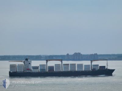
Container Ship
Current Trip
| Time Travelled | 5 days |
|---|---|
| Remaining Time | 7 days |
| Distance Travelled | 2202.13 nm |
| Remaining Distance | 3407.11 nm |
| AVG Speed | 16.8 Knots |
| MAX Speed | 19.6 Knots |
| AVG Wind | 7.7 knots |
| MAX Wind | 26 knots |
| MIN Temp | 11.8°C / 53.24°F |
| MAX Temp | 19.1°C / 66.38°F |
| Draught | 11.5 m |
| Position Received | 4 d ago |
Current Position
| Longitude | -5.04141° |
|---|---|
| Latitude | 49.57053° |
| Status | Under way using engine |
| Speed | 16.8 Knots |
| Course | 246.9° |
| Area | English Channel |
| Station | T-AIS |
| Position Received | 4 d ago |
Info
Information
The current position of GARDINER is in English Channel with coordinates 49.57053° / -5.04141° as reported on 2024-05-25 03:44 by AIS to our vessel tracker app. The vessel's current speed is 16.8 Knots and is heading at the port of VERACRUZ. The estimated time of arrival as calculated by vessel tracking app is 2024-06-05 19:18 LT
The vessel GARDINER (IMO: 9275048, MMSI: 636017520) is a Container Ship that was built in 2003 ( 21 years old ). It's sailing under the flag of [LR] Liberia.
In this page you can find informations about the vessels current position, last detected port calls, and current voyage information. If the vessels is not in coverage by AIS you will find the latest position.
The current position of GARDINER is detected by our AIS receivers and we are not responsible for the reliability of the data. The last position was recorded while the vessel was in Coverage by the Ais receivers of our vessel tracking app.
The current draught of GARDINER as reported by AIS is 11.5 meters
Weather
| Temperature | 17.3°C / 63.14°F |
|---|---|
| Wind Speed | 21 knots |
| Direction | 301° WNW |
| Pressure | 1017.1 hPa |
| Humidity | 63.9 % |
| Cloud Coverage | 22 % |
Featured Company
Last Port Calls
| Port | Arrival | Departure | Time In Port |
|---|---|---|---|
| 2024-05-22 19:06 | 2024-05-23 12:10 | 17 h | |
| 2024-05-20 15:55 | 2024-05-21 15:00 | 23 h | |
| 2024-05-18 03:57 | 2024-05-19 12:12 | 1 d | |
| 2024-05-16 12:55 | 2024-05-17 08:37 | 19 h | |
| 2024-05-05 01:20 | 2024-05-05 15:41 | 14 h | |
| 2024-04-30 03:57 | 2024-05-02 14:34 | 2 d | |
| 2024-04-27 10:58 | 2024-04-28 22:54 | 1 d | |
| 2024-04-04 10:47 | 2024-04-05 07:47 | 20 h | |
| 2024-04-03 01:43 | 2024-04-03 17:20 | 15 h | |
| 2024-03-30 20:49 | 2024-03-31 21:43 | 1 d |
Most Visited Ports (Last year)
| Port | Arrivals | |
|---|---|---|
| 5 | ||
| 5 | ||
| 4 | ||
| 3 | ||
| 2 | ||
| 1 |
Last Trips
| Origin | Departure | Destination | Arrival | Distance | |
|---|---|---|---|---|---|
| 2024-05-21 17:00 | 2024-05-22 21:06 | 116.46 nm | |||
| 2024-05-19 14:12 | 2024-05-20 17:55 | 442.95 nm | |||
| 2024-05-17 09:37 | 2024-05-18 05:57 | 264.16 nm | |||
| 2024-05-05 10:41 | 2024-05-16 13:55 | 4318.28 nm | |||
| 2024-05-02 09:34 | 2024-05-04 20:20 | 304.50 nm | |||
| 2024-04-28 17:54 | 2024-04-29 22:57 | 251.91 nm | |||
| 2024-04-05 09:47 | 2024-04-27 05:58 | 7053.82 nm | |||
| 2024-04-03 19:20 | 2024-04-04 12:47 | 271.16 nm | |||
| 2024-03-31 23:43 | 2024-04-03 03:43 | 52.32 nm | |||
| 2024-03-27 06:18 | 2024-03-30 21:49 | 107.61 nm |
Events
| Time | Event | Details | Position / Dest | Info |
|---|---|---|---|---|
| 2024-05-25 03:51 | Status Changed | Default Under way using engine |
49.55801 / -5.08430
VERACRUZ MEXICO
|
Speed: 16.8 kn Course: 246.9° |
| 2024-05-25 03:44 | Status Changed | Under way using engine Default |
49.57053 / -5.04141
VERACRUZ MEXICO
|
Speed: 16.8 kn Course: 251° |
| 2024-05-25 03:44 | OUT of Coverage |
49.57053 / -5.04141
English Channel
VERACRUZ MEXICO
|
Speed: 16.8 kn Course: 246.9° |
|
| 2024-05-25 03:15 | Status Changed | Default Under way using engine |
49.61515 / -4.84051
VERACRUZ MEXICO
|
Speed: 17.3 kn Course: 251.8° |
| 2024-05-25 03:06 | Status Changed | Under way using engine Default |
49.62834 / -4.77803
VERACRUZ MEXICO
|
Speed: 17.5 kn Course: 252° |
| 2024-05-25 02:51 | Status Changed | Default Under way using engine |
49.64972 / -4.66920
VERACRUZ MEXICO
|
Speed: 17.7 kn Course: 253.7° |
| 2024-05-25 00:01 | Change Sea Area | United Kingdom part of the English Channel Guernsey part of the English Channel |
49.86432 / -3.36560
English Channel
VERACRUZ MEXICO
|
Speed: 18.5 kn Course: 259.3° |
| 2024-05-24 23:59 | Status Changed | Under way using engine Default |
49.86610 / -3.34834
VERACRUZ MEXICO
|
Speed: 18.5 kn Course: 264° |
| 2024-05-24 23:15 | Status Changed | Default Under way using engine |
49.93253 / -3.02830
VERACRUZ MEXICO
|
Speed: 17.6 kn Course: 242.3° |
| 2024-05-24 20:44 | Detected in Sea | Guernsey part of the English Channel |
50.12651 / -2.03647
English Channel
VERACRUZ MEXICO
|
Speed: 14.4 kn Course: 255.3° |