
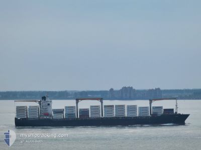
GARDINER
Container Ship
Current Trip
SANTA MARTA COLOMBIA
| Time Travelled | 2 days |
|---|---|
| Remaining Time | --- |
| Distance Travelled | 1056.90 nm |
| Remaining Distance | --- |
| AVG Speed | 17.7 Knots |
| MAX Speed | 19.3 Knots |
| AVG Wind | 14.5 knots |
| MAX Wind | 23.9 knots |
| MIN Temp | 27.4°C / 81.32°F |
| MAX Temp | 29.4°C / 84.92°F |
| Draught | 9.9 m |
| Position Received | 20 h, 29 m ago |
Current Position
| Longitude | -66.53496° |
|---|---|
| Latitude | 20.25780° |
| Status | Under way using engine |
| Speed | 17.7 Knots |
| Course | 45.4° |
| Area | North Atlantic Ocean |
| Station | T-AIS |
| Position Received | 20 h, 29 m ago |
Info
Information
The current position of GARDINER is in North Atlantic Ocean with coordinates 20.25780° / -66.53496° as reported on 2024-06-25 09:28 by AIS to our vessel tracker app. The vessel's current speed is 17.7 Knots
The vessel GARDINER (IMO: 9275048, MMSI: 636017520) is a Container Ship that was built in 2003 ( 21 years old ). It's sailing under the flag of [LR] Liberia.
In this page you can find informations about the vessels current position, last detected port calls, and current voyage information. If the vessels is not in coverage by AIS you will find the latest position.
The current position of GARDINER is detected by our AIS receivers and we are not responsible for the reliability of the data. The last position was recorded while the vessel was in Coverage by the Ais receivers of our vessel tracking app.
The current draught of GARDINER as reported by AIS is 9.9 meters
Weather
| Temperature | 27.4°C / 81.32°F |
|---|---|
| Wind Speed | 8 knots |
| Direction | 112° ESE |
| Pressure | 1019.9 hPa |
| Humidity | 82.7 % |
| Cloud Coverage | 100 % |
Featured Company
Last Port Calls
| Port | Arrival | Departure | Time In Port |
|---|---|---|---|
| 2024-06-23 02:54 | 2024-06-23 17:52 | 14 h | |
| 2024-06-18 12:54 | 2024-06-21 05:09 | 2 d | |
| 2024-06-15 12:00 | 2024-06-16 11:07 | 23 h | |
| 2024-05-22 19:06 | 2024-05-23 12:10 | 17 h | |
| 2024-05-20 15:55 | 2024-05-21 15:00 | 23 h | |
| 2024-05-18 03:57 | 2024-05-19 12:12 | 1 d | |
| 2024-05-16 12:55 | 2024-05-17 08:37 | 19 h | |
| 2024-05-05 01:20 | 2024-05-05 15:41 | 14 h | |
| 2024-04-30 03:57 | 2024-05-02 14:34 | 2 d | |
| 2024-04-27 10:58 | 2024-04-28 22:54 | 1 d |
Most Visited Ports (Last year)
| Port | Arrivals | |
|---|---|---|
| 5 | ||
| 5 | ||
| 3 | ||
| 3 | ||
| 2 | ||
| 2 |
Last Trips
| Origin | Departure | Destination | Arrival | Distance | |
|---|---|---|---|---|---|
| 2024-06-21 00:09 | 2024-06-22 21:54 | 337.86 nm | |||
| 2024-06-16 06:07 | 2024-06-18 07:54 | 283.07 nm | |||
| 2024-05-23 14:10 | 2024-06-15 07:00 | 7698.61 nm | |||
| 2024-05-21 17:00 | 2024-05-22 21:06 | 116.46 nm | |||
| 2024-05-19 14:12 | 2024-05-20 17:55 | 442.95 nm | |||
| 2024-05-17 09:37 | 2024-05-18 05:57 | 264.16 nm | |||
| 2024-05-05 10:41 | 2024-05-16 13:55 | 4318.28 nm | |||
| 2024-05-02 09:34 | 2024-05-04 20:20 | 304.50 nm | |||
| 2024-04-28 17:54 | 2024-04-29 22:57 | 251.91 nm | |||
| 2024-04-05 09:47 | 2024-04-27 05:58 | 7053.82 nm |
Events
| Time | Event | Details | Position / Dest | Info |
|---|---|---|---|---|
| 2024-06-25 09:34 | Status Changed | Default Under way using engine |
20.27892 / -66.51251
SANTA MARTA COLOMBIA
|
Speed: 17.7 kn Course: 45.4° |
| 2024-06-25 09:28 | Status Changed | Under way using engine Default |
20.25780 / -66.53496
SANTA MARTA COLOMBIA
|
Speed: 17.6 kn Course: 44° |
| 2024-06-25 09:28 | OUT of Coverage |
20.25780 / -66.53496
North Atlantic Ocean
|
Speed: 17.7 kn Course: 45.4° |
|
| 2024-06-25 09:15 | Status Changed | Default Under way using engine |
20.21056 / -66.58531
SANTA MARTA COLOMBIA
|
Speed: 17.6 kn Course: 45.3° |
| 2024-06-25 09:10 | Status Changed | Under way using engine Default |
20.19475 / -66.60263
SANTA MARTA COLOMBIA
|
Speed: 17.6 kn Course: 46° |
| 2024-06-25 09:02 | IN Coverage |
20.19475 / -66.60263
North Atlantic Ocean
|
Speed: 17.6 kn Course: 45.3° |
|
| 2024-06-25 07:19 | Status Changed | Default Under way using engine |
19.83839 / -67.00120
SANTA MARTA COLOMBIA
|
Speed: 11.7 kn Course: 48.8° |
| 2024-06-25 07:14 | OUT of Coverage |
19.83105 / -67.01207
North Atlantic Ocean
|
Speed: 11.7 kn Course: 48.8° |
|
| 2024-06-25 07:13 | Status Changed | Under way using engine Default |
19.82879 / -67.01482
SANTA MARTA COLOMBIA
|
Speed: 17.8 kn Course: 47° |
| 2024-06-25 07:06 | Status Changed | Default Under way using engine |
19.80881 / -67.03864
SANTA MARTA COLOMBIA
|
Speed: 17.9 kn Course: 44.2° |