
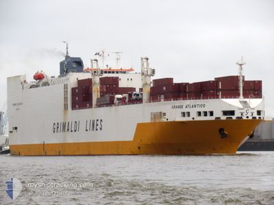
GRANDE ATLANTICO
Vehicles Carrier
Current Trip
| Trip Time | 1 day |
|---|---|
| Trip Distance | 666.30 nm |
| AVG Speed | 13.9 Knots |
| MAX Speed | 17.5 Knots |
| Draught | 9.5 m |
| AVG Wind | 9.4 knots |
| MAX Wind | 14 knots |
| MIN Temp | 25.6°C / 78.08°F |
| MAX Temp | 28°C / 82.4°F |
| Position Received | 22 d ago |
Current Position
| Longitude | -16.50193° |
|---|---|
| Latitude | 27.39376° |
| Status | Under way using engine |
| Speed | 15.7 Knots |
| Course | 192° |
| Area | North Atlantic Ocean |
| Station | T-AIS |
| Position Received | 22 d ago |
Info
Information
The current position of GRANDE ATLANTICO is in North Atlantic Ocean with coordinates 27.39376° / -16.50193° as reported on 2024-05-12 04:04 by AIS to our vessel tracker app. The vessel's current speed is 15.7 Knots and is currently inside the port of DOUALA.
The vessel GRANDE ATLANTICO (IMO: 9130951, MMSI: 215665000) is a Vehicles Carrier that was built in 1999 ( 25 years old ). It's sailing under the flag of [MT] Malta.
In this page you can find informations about the vessels current position, last detected port calls, and current voyage information. If the vessels is not in coverage by AIS you will find the latest position.
The current position of GRANDE ATLANTICO is detected by our AIS receivers and we are not responsible for the reliability of the data. The last position was recorded while the vessel was in Coverage by the Ais receivers of our vessel tracking app.
The current draught of GRANDE ATLANTICO as reported by AIS is 9.5 meters
Weather
| Temperature | 30.3°C / 86.54°F |
|---|---|
| Wind Speed | 8 knots |
| Direction | 228° SW |
| Pressure | 1011.5 hPa |
| Humidity | 65.3 % |
| Cloud Coverage | 77 % |
Featured Company
Last Port Calls
| Port | Arrival | Departure | Time In Port |
|---|---|---|---|
| 2024-06-02 15:06 | |||
| 2024-05-30 13:09 | 2024-05-31 16:49 | 1 d | |
| 2024-05-27 09:52 | 2024-05-28 19:19 | 1 d | |
| 2024-05-23 15:48 | 2024-05-24 07:36 | 15 h | |
| 2024-05-18 13:02 | 2024-05-20 17:56 | 2 d | |
| 2024-05-14 07:26 | 2024-05-17 03:58 | 2 d | |
| 2024-05-09 07:39 | 2024-05-09 18:20 | 10 h | |
| 2024-05-05 18:10 | 2024-05-06 16:57 | 22 h | |
| 2024-04-30 16:12 | 2024-05-05 00:57 | 4 d | |
| 2024-04-25 12:18 | 2024-04-26 07:10 | 18 h |
Last Trips
| Origin | Departure | Destination | Arrival | Distance | |
|---|---|---|---|---|---|
| 2024-05-31 17:49 | 2024-06-02 16:06 | 666.30 nm | |||
| 2024-05-28 20:19 | 2024-05-30 14:09 | 305.32 nm | |||
| 2024-05-24 07:36 | 2024-05-27 10:52 | 1150.60 nm | |||
| 2024-05-20 17:56 | 2024-05-23 15:48 | 1115.07 nm | |||
| 2024-05-17 03:58 | 2024-05-18 13:02 | 496.27 nm | |||
| 2024-05-09 19:20 | 2024-05-14 07:26 | 1701.95 nm | |||
| 2024-05-06 18:57 | 2024-05-09 08:39 | 784.65 nm | |||
| 2024-05-05 02:57 | 2024-05-05 20:10 | 262.08 nm | |||
| 2024-04-26 08:10 | 2024-04-30 18:12 | 1401.16 nm | |||
| 2024-04-15 12:37 | 2024-04-25 13:18 | 3511.35 nm |
Events
| Time | Event | Details | Position / Dest | Info |
|---|---|---|---|---|
| 2024-06-02 15:06 | STOP Moving |
4.04227 / 9.67635
[CM] DOUALA
|
Speed: 0.2 kn Course: 67° |
|
| 2024-06-02 15:06 | PORT ARRIVAL |
|
4.04227 / 9.67635
[CM] DOUALA
|
Speed: 1.2 kn Course: 68° |
| 2024-06-02 12:54 | START Moving | 16.01 nm, South West of DOUALA |
3.87211 / 9.49493
PT LEI > SN DKR
|
Speed: 3.3 kn Course: 322° |
| 2024-06-02 09:28 | STOP Moving | 15.85 nm, South West of DOUALA |
3.87193 / 9.49884
PT LEI > SN DKR
|
Speed: 0.3 kn Course: 226° |
| 2024-05-31 16:49 | PORT DEPARTURE |
|
-4.77118 / 11.83147
PT LEI > SN DKR
|
Speed: 4.4 kn Course: 344° |
| 2024-05-31 16:37 | START Moving |
-4.78143 / 11.82936
[CG] POINTE NOIRE
|
Speed: 3.4 kn Course: 98° |
|
| 2024-05-30 13:37 | STOP Moving |
-4.78047 / 11.82572
[CG] POINTE NOIRE
|
Speed: 0.3 kn Course: 176° |
|
| 2024-05-30 13:09 | PORT ARRIVAL |
|
-4.77384 / 11.83331
[CG] POINTE NOIRE
|
Speed: 5.2 kn Course: 127° |
| 2024-05-30 11:57 | START Moving | 3.62 nm, North West of POINTE NOIRE |
-4.74558 / 11.78508
PT LEI > SN DKR
|
Speed: 4.9 kn Course: 114° |
| 2024-05-29 13:44 | STOP Moving | 4.4 nm, North West of POINTE NOIRE |
-4.74216 / 11.77172
PT LEI > SN DKR
|
Speed: 0.2 kn Course: 154° |