
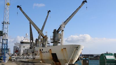
GREEN SELJE
Reefer
Current Trip
| Time Travelled | 14 days |
|---|---|
| Remaining Time | --- |
| Distance Travelled | 1993.56 nm |
| Remaining Distance | --- |
| AVG Speed | 12 Knots |
| MAX Speed | 15.3 Knots |
| AVG Wind | 14.3 knots |
| MAX Wind | 25 knots |
| MIN Temp | 16°C / 60.8°F |
| MAX Temp | 29.1°C / 84.38°F |
| Draught | 5.9 m |
| Position Received | 14 d ago |
Current Position
| Longitude | -15.31145° |
|---|---|
| Latitude | 27.57501° |
| Status | Under way using engine |
| Speed | 14.2 Knots |
| Course | 201° |
| Area | North Atlantic Ocean |
| Station | T-AIS |
| Position Received | 14 d ago |
Info
Information
The current position of GREEN SELJE is in North Atlantic Ocean with coordinates 27.57501° / -15.31145° as reported on 2024-05-15 00:08 by AIS to our vessel tracker app. The vessel's current speed is 14.2 Knots and is heading at the port of NOUADHIBOU.
The vessel GREEN SELJE (IMO: 8804529, MMSI: 308541000) is a Reefer that was built in 1989 ( 35 years old ). It's sailing under the flag of [BS] Bahamas.
In this page you can find informations about the vessels current position, last detected port calls, and current voyage information. If the vessels is not in coverage by AIS you will find the latest position.
The current position of GREEN SELJE is detected by our AIS receivers and we are not responsible for the reliability of the data. The last position was recorded while the vessel was in Coverage by the Ais receivers of our vessel tracking app.
The current draught of GREEN SELJE as reported by AIS is 5.9 meters
Weather
| Temperature | 28.6°C / 83.48°F |
|---|---|
| Wind Speed | 7 knots |
| Direction | 159° SSE |
| Pressure | 1012.7 hPa |
| Humidity | 67.2 % |
| Cloud Coverage | 51 % |
Featured Company
Last Port Calls
| Port | Arrival | Departure | Time In Port |
|---|---|---|---|
| 2024-05-13 20:52 | 2024-05-14 21:21 | 1 d | |
| 2024-05-09 18:50 | 2024-05-10 10:56 | 16 h | |
| 2024-04-12 15:21 | 2024-04-26 10:52 | 13 d |
Most Visited Ports (Last year)
| Port | Arrivals | |
|---|---|---|
| 6 | ||
| 3 | ||
| 2 | ||
| 2 | ||
| 1 | ||
| 1 |
Last Trips
| Origin | Departure | Destination | Arrival | Distance | |
|---|---|---|---|---|---|
| 2024-05-10 11:56 | 2024-05-13 21:52 | 19.80 nm | |||
| 2024-04-26 11:52 | 2024-05-09 19:50 | 3413.30 nm | |||
| 2024-02-19 00:28 | 2024-04-12 16:21 | 2483.14 nm |
Events
| Time | Event | Details | Position / Dest | Info |
|---|---|---|---|---|
| 2024-05-27 18:03 | START Moving |
3.83327 / -5.47123
MRNDB
|
Speed: 4.9 kn Course: 128° |
|
| 2024-05-27 17:09 | STOP Moving |
3.82467 / -5.47727
MRNDB
|
Speed: 0.2 kn Course: 200° |
|
| 2024-05-22 16:13 | START Moving | 2.26 nm, East of NOUADHIBOU |
20.89331 / -17.00275
MRNDB
|
Speed: 4.6 kn Course: 213° |