
LADY LILLY
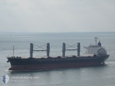
Bulk Carrier
Current Trip
| Time Travelled | 25 days |
|---|---|
| Remaining Time | --- |
| Distance Travelled | 2426.96 nm |
| Remaining Distance | --- |
| AVG Speed | 17 Knots |
| MAX Speed | 17 Knots |
| AVG Wind | 8 knots |
| MAX Wind | 23 knots |
| MIN Temp | 18.7°C / 65.66°F |
| MAX Temp | 31.5°C / 88.7°F |
| Draught | 9.9 m |
| Position Received | 4 m ago |
Current Position
| Longitude | 28.48350° |
|---|---|
| Latitude | 32.87307° |
| Status | Under way using engine |
| Speed | 11.7 Knots |
| Course | 290.1° |
| Area | Mediterranean Sea - Eastern Basin |
| Station | T-AIS |
| Position Received | 4 m ago |
Info
Information
The current position of LADY LILLY is in Mediterranean Sea - Eastern Basin with coordinates 32.87307° / 28.48350° as reported on 2024-06-21 20:13 by AIS to our vessel tracker app. The vessel's current speed is 11.7 Knots and is heading at the port of VLISSINGEN. The estimated time of arrival as calculated by vessel tracking app is 2024-07-02 02:25 LT
The vessel LADY LILLY (IMO: 9642021, MMSI: 636018886) is a Bulk Carrier that was built in 2013 ( 11 years old ). It's sailing under the flag of [LR] Liberia.
In this page you can find informations about the vessels current position, last detected port calls, and current voyage information. If the vessels is not in coverage by AIS you will find the latest position.
The current position of LADY LILLY is detected by our AIS receivers and we are not responsible for the reliability of the data. The last position was recorded while the vessel was in Coverage by the Ais receivers of our vessel tracking app.
The current draught of LADY LILLY as reported by AIS is 9.9 meters
Weather
| Temperature | 25.7°C / 78.26°F |
|---|---|
| Wind Speed | 8 knots |
| Direction | 287° WNW |
| Pressure | 1006.6 hPa |
| Humidity | 81.9 % |
| Cloud Coverage | --- |
Featured Company
Last Port Calls
Last Trips
| Origin | Departure | Destination | Arrival | Distance | |
|---|---|---|---|---|---|
| 2024-05-27 15:32 | 2024-06-19 00:47 | 2191.20 nm | |||
| 2024-05-04 09:38 | 2024-05-23 08:49 | 490.88 nm | |||
| 2024-04-19 15:02 | 2024-04-30 04:43 | 437.34 nm | |||
| 2024-04-04 16:19 | 2024-04-10 22:18 | 253.03 nm | |||
| 2024-03-29 21:32 | 2024-04-03 03:22 | 1200.88 nm |
Events
| Time | Event | Details | Position / Dest | Info |
|---|---|---|---|---|
| 2024-06-21 19:48 | Status Changed | Under way using engine Default |
32.84439 / 28.57182
NLVLI
|
Speed: 11.5 kn Course: 292° |
| 2024-06-21 19:45 | Status Changed | Default Under way using engine |
32.84101 / 28.58171
NLVLI
|
Speed: 11.5 kn Course: 292° |
| 2024-06-21 19:23 | Status Changed | Under way using engine Default |
32.81477 / 28.65919
NLVLI
|
Speed: 11.6 kn Course: 292° |
| 2024-06-21 19:15 | Status Changed | Default Under way using engine |
32.80521 / 28.68741
NLVLI
|
Speed: 11.7 kn Course: 291.9° |
| 2024-06-21 18:59 | Status Changed | Under way using engine Default |
32.78524 / 28.74698
NLVLI
|
Speed: 11.9 kn Course: 292° |
| 2024-06-21 18:46 | IN Coverage |
32.78524 / 28.74698
Mediterranean Sea - Eastern Basin
NLVLI
|
Speed: 11.8 kn Course: 291.8° |
|
| 2024-06-21 16:29 | Status Changed | Default Under way using engine |
32.61655 / 29.29103
NLVLI
|
Speed: 11.7 kn Course: 291.2° |
| 2024-06-21 16:21 | OUT of Coverage |
32.60683 / 29.32098
Mediterranean Sea - Eastern Basin
NLVLI
|
Speed: 11.7 kn Course: 291.2° |
|
| 2024-06-21 15:57 | Status Changed | Under way using engine Default |
32.58229 / 29.40802
NLVLI
|
Speed: 11.5 kn Course: 287° |
| 2024-06-21 15:17 | Status Changed | Default Under way using engine |
32.54534 / 29.55584
NLVLI
|
Speed: 11.6 kn Course: 286.5° |