
LAKE ONTARIO
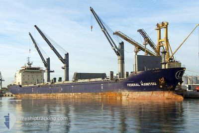
Bulk Carrier
Current Trip
| Time Travelled | 3 days |
|---|---|
| Remaining Time | --- |
| Distance Travelled | 243.24 nm |
| Remaining Distance | --- |
| AVG Speed | 11.3 Knots |
| MAX Speed | 13.5 Knots |
| AVG Wind | 7.8 knots |
| MAX Wind | 16 knots |
| MIN Temp | 25.4°C / 77.72°F |
| MAX Temp | 29°C / 84.2°F |
| Draught | 9.3 m |
| Position Received | 20 d ago |
Current Position
| Longitude | -16.66159° |
|---|---|
| Latitude | 26.93723° |
| Status | Under way using engine |
| Speed | 12 Knots |
| Course | 195.9° |
| Area | North Atlantic Ocean |
| Station | T-AIS |
| Position Received | 20 d ago |
Info
Information
The current position of LAKE ONTARIO is in North Atlantic Ocean with coordinates 26.93723° / -16.66159° as reported on 2024-05-17 01:40 by AIS to our vessel tracker app. The vessel's current speed is 12 Knots and is heading at the port of LIBREVILLE. The estimated time of arrival as calculated by vessel tracking app is 2024-05-26 11:00 LT
The vessel LAKE ONTARIO (IMO: 9283538, MMSI: 304603000) is a Bulk Carrier that was built in 2004 ( 20 years old ). It's sailing under the flag of [AG] Antigua Barbuda.
In this page you can find informations about the vessels current position, last detected port calls, and current voyage information. If the vessels is not in coverage by AIS you will find the latest position.
The current position of LAKE ONTARIO is detected by our AIS receivers and we are not responsible for the reliability of the data. The last position was recorded while the vessel was in Coverage by the Ais receivers of our vessel tracking app.
The current draught of LAKE ONTARIO as reported by AIS is 9.3 meters
Weather
| Temperature | 27.3°C / 81.14°F |
|---|---|
| Wind Speed | 9 knots |
| Direction | 207° SSW |
| Pressure | 1014.1 hPa |
| Humidity | 80 % |
| Cloud Coverage | 98 % |
Featured Company
Last Port Calls
| Port | Arrival | Departure | Time In Port |
|---|---|---|---|
| 2024-05-28 08:35 | 2024-06-02 21:22 | 5 d | |
| 2024-04-29 08:53 | 2024-05-02 23:30 | 3 d | |
| 2024-04-28 10:06 | 2024-04-28 10:46 | 40 m | |
| 2024-04-26 09:52 | 2024-04-28 09:18 | 1 d | |
| 2024-04-26 08:34 | 2024-04-26 09:17 | 43 m | |
| 2024-04-09 18:18 |
Last Trips
| Origin | Departure | Destination | Arrival | Distance | |
|---|---|---|---|---|---|
| 2024-05-03 01:30 | 2024-05-28 09:35 | 4877.18 nm | |||
| 2024-04-28 12:46 | 2024-04-29 10:53 | 258.56 nm | |||
| 2024-04-28 11:18 | 2024-04-28 12:06 | 3.02 nm | |||
| 2024-04-26 11:17 | 2024-04-26 11:52 | 3.09 nm | |||
| 2024-04-09 19:18 | 2024-04-26 10:34 | 4465.77 nm |
Events
| Time | Event | Details | Position / Dest | Info |
|---|---|---|---|---|
| 2024-06-04 19:17 | STOP Moving | 14.84 nm, South West of DOUALA |
3.87659 / 9.51795
LIBREVILLE
|
Speed: 0.3 kn Course: 69° |
| 2024-06-04 18:56 | START Moving | 14.96 nm, South West of DOUALA |
3.87570 / 9.51596
LIBREVILLE
|
Speed: 4.1 kn Course: 29° |
| 2024-06-03 16:47 | STOP Moving | 14.57 nm, South West of DOUALA |
3.88160 / 9.51940
LIBREVILLE
|
Speed: 0.3 kn Course: 127° |
| 2024-06-02 21:22 | START Moving | 0.75 nm, West of OWENDO |
.28069 / 9.49468
LIBREVILLE
|
Speed: 5.8 kn Course: 275° |
| 2024-06-02 21:22 | PORT DEPARTURE |
|
.28069 / 9.49468
LIBREVILLE
|
Speed: 1.3 kn Course: 284° |
| 2024-05-28 08:57 | STOP Moving |
.28543 / 9.50971
[GA] OWENDO
|
Speed: 0.2 kn Course: 31° |
|
| 2024-05-28 08:35 | PORT ARRIVAL |
|
.28543 / 9.50971
[GA] OWENDO
|
Speed: 5.3 kn Course: 89° |
| 2024-05-28 07:22 | START Moving | 5.31 nm, South of LIBREVILLE |
.31204 / 9.41460
LIBREVILLE
|
Speed: 4.9 kn Course: 120° |