
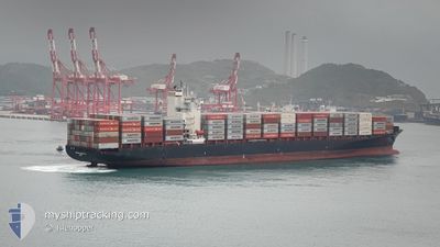
MERKUR ARCHIPELAGO
Container Ship
Current Trip
| Time Travelled | 7 days |
|---|---|
| Remaining Time | --- |
| Distance Travelled | 2673.91 nm |
| Remaining Distance | 29.33 nm |
| AVG Speed | 15 Knots |
| MAX Speed | 20.1 Knots |
| AVG Wind | 12.7 knots |
| MAX Wind | 27.7 knots |
| MIN Temp | 16.5°C / 61.7°F |
| MAX Temp | 29°C / 84.2°F |
| Draught | 12.1 m |
| Position Received | 6 d ago |
Current Position
| Longitude | -13.97542° |
|---|---|
| Latitude | 27.35641° |
| Status | Under way using engine |
| Speed | 18.6 Knots |
| Course | 218.2° |
| Area | North Atlantic Ocean |
| Station | T-AIS |
| Position Received | 6 d ago |
Info
Information
The current position of MERKUR ARCHIPELAGO is in North Atlantic Ocean with coordinates 27.35641° / -13.97542° as reported on 2024-05-12 14:28 by AIS to our vessel tracker app. The vessel's current speed is 18.6 Knots and is heading at the port of ABIDJAN. The estimated time of arrival as calculated by vessel tracking app is 2024-05-17 10:00 LT
The vessel MERKUR ARCHIPELAGO (IMO: 9456977, MMSI: 636091883) is a Container Ship that was built in 2009 ( 15 years old ). It's sailing under the flag of [LR] Liberia.
In this page you can find informations about the vessels current position, last detected port calls, and current voyage information. If the vessels is not in coverage by AIS you will find the latest position.
The current position of MERKUR ARCHIPELAGO is detected by our AIS receivers and we are not responsible for the reliability of the data. The last position was recorded while the vessel was in Coverage by the Ais receivers of our vessel tracking app.
The current draught of MERKUR ARCHIPELAGO as reported by AIS is 12.1 meters
Weather
| Temperature | 28.4°C / 83.12°F |
|---|---|
| Wind Speed | 11 knots |
| Direction | 212° SSW |
| Pressure | 1011.5 hPa |
| Humidity | 81.7 % |
| Cloud Coverage | 100 % |
Featured Company
Last Port Calls
| Port | Arrival | Departure | Time In Port |
|---|---|---|---|
| 2024-05-10 12:59 | 2024-05-11 00:54 | 11 h | |
| 2024-04-28 23:10 | 2024-04-30 18:58 | 1 d | |
| 2024-04-19 21:32 | 2024-04-20 16:51 | 19 h | |
| 2024-04-19 02:56 | 2024-04-19 12:59 | 10 h | |
| 2024-04-09 06:43 | 2024-04-10 19:16 | 1 d | |
| 2024-03-31 17:30 | 2024-04-01 08:38 | 15 h | |
| 2024-03-18 09:56 | |||
| 2024-03-09 22:38 | 2024-03-10 12:32 | 13 h |
Most Visited Ports (Last year)
| Port | Arrivals | |
|---|---|---|
| 9 | ||
| 7 | ||
| 5 | ||
| 5 | ||
| 5 | ||
| 4 |
Last Trips
| Origin | Departure | Destination | Arrival | Distance | |
|---|---|---|---|---|---|
| 2024-04-30 18:58 | 2024-05-10 13:59 | 2824.49 nm | |||
| 2024-04-20 18:51 | 2024-04-28 23:10 | 2717.70 nm | |||
| 2024-04-19 13:59 | 2024-04-19 23:32 | 50.79 nm | |||
| 2024-04-10 19:16 | 2024-04-19 03:56 | 2847.13 nm | |||
| 2024-04-01 08:38 | 2024-04-09 06:43 | 2783.90 nm | |||
| 2024-03-18 09:56 | 2024-03-31 17:30 | 2971.30 nm | |||
| 2024-02-24 05:51 | 2024-03-09 23:38 | 3875.94 nm |
Events
| Time | Event | Details | Position / Dest | Info |
|---|---|---|---|---|
| 2024-05-18 11:25 | STOP Moving |
4.85500 / -4.23667
ABIDJAN
|
Speed: Course: -1° |
|
| 2024-05-12 14:34 | Status Changed | Default Under way using engine |
27.33333 / -13.99333
ABIDJAN
|
Speed: 18.6 kn Course: 218.2° |
| 2024-05-12 14:28 | Change Sea Area | Western Saharan part of the North Atlantic Ocean Moroccan part of the North Atlantic Ocean |
27.35641 / -13.97542
North Atlantic Ocean
ABIDJAN
|
Speed: 18.6 kn Course: 218.2° |
| 2024-05-12 14:28 | Status Changed | Under way using engine Default |
27.35641 / -13.97542
ABIDJAN
|
Speed: 18.6 kn Course: 219° |
| 2024-05-12 14:28 | IN Coverage |
27.35641 / -13.97542
North Atlantic Ocean
ABIDJAN
|
Speed: 18.6 kn Course: 218.2° |
|
| 2024-05-12 14:28 | OUT of Coverage |
27.35641 / -13.97542
North Atlantic Ocean
ABIDJAN
|
Speed: 18.6 kn Course: 218.2° |
|
| 2024-05-12 13:10 | Status Changed | Default Under way using engine |
27.67167 / -13.69833
ABIDJAN
|
Speed: 17.9 kn Course: 217.3° |
| 2024-05-12 13:02 | OUT of Coverage |
27.70307 / -13.67247
North Atlantic Ocean
ABIDJAN
|
Speed: 17.9 kn Course: 217.3° |
|
| 2024-05-12 12:54 | Status Changed | Under way using engine Default |
27.73522 / -13.64433
ABIDJAN
|
Speed: 18.1 kn Course: 217° |
| 2024-05-12 12:49 | Status Changed | Default Under way using engine |
27.75358 / -13.62824
ABIDJAN
|
Speed: 18.2 kn Course: 218.5° |