
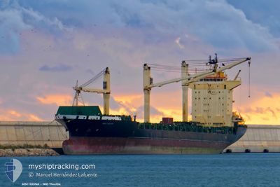
MSC RIONA
Container Ship
Current Trip
| Time Travelled | 4 days |
|---|---|
| Remaining Time | --- |
| Distance Travelled | 1087.45 nm |
| Remaining Distance | --- |
| AVG Speed | 12.1 Knots |
| MAX Speed | 17.3 Knots |
| AVG Wind | 8.3 knots |
| MAX Wind | 17 knots |
| MIN Temp | 24.3°C / 75.74°F |
| MAX Temp | 37.6°C / 99.68°F |
| Draught | 7.4 m |
| Position Received | 1 d ago |
Current Position
| Longitude | 106.94370° |
|---|---|
| Latitude | 10.46086° |
| Status | Under way using engine |
| Speed | 13.3 Knots |
| Course | 153.5° |
| Area | South China Sea |
| Station | T-AIS |
| Position Received | 1 d ago |
Info
Information
The current position of MSC RIONA is in South China Sea with coordinates 10.46086° / 106.94370° as reported on 2024-05-27 09:27 by AIS to our vessel tracker app. The vessel's current speed is 13.3 Knots
The vessel MSC RIONA (IMO: 9144134, MMSI: 636020871) is a Container Ship that was built in 1998 ( 26 years old ). It's sailing under the flag of [LR] Liberia.
In this page you can find informations about the vessels current position, last detected port calls, and current voyage information. If the vessels is not in coverage by AIS you will find the latest position.
The current position of MSC RIONA is detected by our AIS receivers and we are not responsible for the reliability of the data. The last position was recorded while the vessel was in Coverage by the Ais receivers of our vessel tracking app.
The current draught of MSC RIONA as reported by AIS is 7.4 meters
Weather
| Temperature | 30.2°C / 86.36°F |
|---|---|
| Wind Speed | 11 knots |
| Direction | 216° SW |
| Pressure | 1008.8 hPa |
| Humidity | 78.3 % |
| Cloud Coverage | 100 % |
Featured Company
Last Port Calls
| Port | Arrival | Departure | Time In Port |
|---|---|---|---|
| 2024-05-21 22:18 | 2024-05-24 05:20 | 2 d | |
| 2024-05-21 12:19 | 2024-05-21 20:29 | 8 h | |
| 2024-05-15 16:03 | 2024-05-16 02:31 | 10 h | |
| 2024-05-12 10:39 | 2024-05-13 09:27 | 22 h | |
| 2024-05-10 04:23 | 2024-05-10 23:04 | 18 h | |
| 2024-05-08 13:36 | 2024-05-08 23:24 | 9 h | |
| 2024-05-07 18:54 | 2024-05-08 09:45 | 14 h | |
| 2024-04-27 04:27 | 2024-04-27 15:56 | 11 h | |
| 2024-04-24 19:16 | 2024-04-25 09:16 | 14 h | |
| 2024-04-23 13:28 | 2024-04-23 23:36 | 10 h |
Last Trips
| Origin | Departure | Destination | Arrival | Distance | |
|---|---|---|---|---|---|
| 2024-05-22 04:29 | 2024-05-22 06:18 | 19.09 nm | |||
| 2024-05-16 09:31 | 2024-05-21 20:19 | 1824.73 nm | |||
| 2024-05-13 17:27 | 2024-05-15 23:03 | 598.69 nm | |||
| 2024-05-11 07:04 | 2024-05-12 18:39 | 203.43 nm | |||
| 2024-05-09 07:24 | 2024-05-10 12:23 | 192.53 nm | |||
| 2024-05-08 17:45 | 2024-05-08 21:36 | 29.35 nm | |||
| 2024-04-27 23:56 | 2024-05-08 02:54 | 1890.03 nm | |||
| 2024-04-25 16:16 | 2024-04-27 12:27 | 549.72 nm | |||
| 2024-04-24 06:36 | 2024-04-25 02:16 | 203.60 nm | |||
| 2024-04-18 23:54 | 2024-04-23 20:28 | 888.20 nm |
Events
| Time | Event | Details | Position / Dest | Info |
|---|---|---|---|---|
| 2024-05-28 00:26 | START Moving | 2.62 nm, South West of CAI MEP |
10.50556 / 107.00118
VNVUT
|
Speed: 7.8 kn Course: 233° |
| 2024-05-27 15:33 | STOP Moving | 2.47 nm, South West of CAI MEP |
10.50500 / 107.00667
VNVUT
|
Speed: Course: -1° |
| 2024-05-27 09:33 | Status Changed | Default Under way using engine |
10.44219 / 106.95625
VNVUT
|
Speed: 13.3 kn Course: 153.5° |
| 2024-05-27 09:27 | OUT of Coverage |
10.46086 / 106.94370
South China Sea
VNVUT
|
Speed: 13.3 kn Course: 153.5° |
|
| 2024-05-27 09:25 | Status Changed | Under way using engine Default |
10.46638 / 106.94118
VNVUT
|
Speed: 13.3 kn Course: 218° |
| 2024-05-27 09:17 | Status Changed | Default Under way using engine |
10.49379 / 106.95074
VNVUT
|
Speed: 11.8 kn Course: 173.6° |
| 2024-05-27 09:09 | Status Changed | Under way using engine Default |
10.52071 / 106.94447
VNVUT
|
Speed: 12.2 kn Course: 113° |
| 2024-05-27 08:49 | Status Changed | Default Under way using engine |
10.51930 / 106.88586
VNVUT
|
Speed: 13.2 kn Course: 142.6° |
| 2024-05-27 06:18 | START Moving | 16.38 nm, North West of PHU MY |
10.78076 / 106.81830
VNVUT
|
Speed: 4.9 kn Course: 243° |
| 2024-05-27 06:14 | Draught Changed | 7.4 6.2 |
10.78189 / 106.82016
VNVUT
|
Speed: 1.2 kn Course: 266° |