
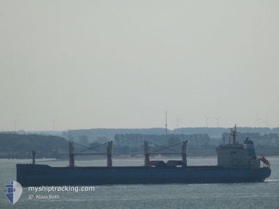
NORDIC NANJING
Bulk Carrier
Current Trip
| Time Travelled | 4 days |
|---|---|
| Remaining Time | 4 days |
| Distance Travelled | 1080.78 nm |
| Remaining Distance | 1061.72 nm |
| AVG Speed | 10.7 Knots |
| MAX Speed | 13.5 Knots |
| AVG Wind | 13.4 knots |
| MAX Wind | 22.4 knots |
| MIN Temp | 11.2°C / 52.16°F |
| MAX Temp | 15.3°C / 59.54°F |
| Draught | 9.9 m |
| Position Received | Now |
Current Position
| Longitude | -4.53306° |
|---|---|
| Latitude | 49.38117° |
| Status | Under way using engine |
| Speed | 11.4 Knots |
| Course | 239.5° |
| Area | English Channel |
| Station | T-AIS |
| Position Received | Now |
Info
Information
The current position of NORDIC NANJING is in English Channel with coordinates 49.38117° / -4.53306° as reported on 2024-05-18 06:28 by AIS to our vessel tracker app. The vessel's current speed is 11.4 Knots and is heading at the port of JORF LASFAR. The estimated time of arrival as calculated by vessel tracking app is 2024-05-22 07:59 LT
The vessel NORDIC NANJING (IMO: 9647291, MMSI: 636018580) is a Bulk Carrier that was built in 2013 ( 11 years old ). It's sailing under the flag of [LR] Liberia.
In this page you can find informations about the vessels current position, last detected port calls, and current voyage information. If the vessels is not in coverage by AIS you will find the latest position.
The current position of NORDIC NANJING is detected by our AIS receivers and we are not responsible for the reliability of the data. The last position was recorded while the vessel was in Coverage by the Ais receivers of our vessel tracking app.
The current draught of NORDIC NANJING as reported by AIS is 9.9 meters
Weather
| Temperature | 13.8°C / 56.84°F |
|---|---|
| Wind Speed | 6 knots |
| Direction | 10° N |
| Pressure | 1013.3 hPa |
| Humidity | 83 % |
| Cloud Coverage | 100 % |
Featured Company
Events
| Time | Event | Details | Position / Dest | Info |
|---|---|---|---|---|
| 2024-05-18 04:59 | Change Sea Area | French part of the English Channel United Kingdom part of the English Channel |
49.52121 / -4.16305
English Channel
MA JFL
|
Speed: 11 kn Course: 239.7° |
| 2024-05-18 00:22 | Change Sea Area | United Kingdom part of the English Channel Guernsey part of the English Channel |
49.93148 / -3.05370
English Channel
MA JFL
|
Speed: 11.3 kn Course: 242.3° |
| 2024-05-17 21:24 | Status Changed | Under way using engine Default |
50.12236 / -2.16114
MA JFL
|
Speed: 13.1 kn Course: 260° |
| 2024-05-17 21:22 | Status Changed | Default Under way using engine |
50.12421 / -2.14350
MA JFL
|
Speed: 13.1 kn Course: 260.4° |
| 2024-05-17 21:01 | Change Sea Area | Guernsey part of the English Channel French part of the English Channel |
50.13864 / -2.03206
English Channel
MA JFL
|
Speed: 13 kn Course: 255° |
| 2024-05-17 20:49 | Change Sea Area | French part of the English Channel United Kingdom part of the English Channel |
50.14929 / -1.96797
English Channel
MA JFL
|
Speed: 12.9 kn Course: 254.8° |
| 2024-05-17 20:49 | Status Changed | Under way using engine Default |
50.14977 / -1.96520
MA JFL
|
Speed: 12.8 kn Course: 255° |
| 2024-05-17 20:10 | Status Changed | Default Under way using engine |
50.18234 / -1.76230
MA JFL
|
Speed: 12.3 kn Course: 257.1° |
| 2024-05-17 07:35 | Change Sea Area | United Kingdom part of the English Channel United Kingdom part of the North Sea |
51.07378 / 1.46423
English Channel
MA JFL
|
Speed: 9.5 kn Course: 230° |
| 2024-05-17 01:50 | Change Sea Area | United Kingdom part of the North Sea Belgian part of the North Sea |
51.85681 / 2.52603
North Sea
MA JFL
|
Speed: 11.3 kn Course: 220.5° |