
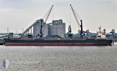
SUBARNAREKHA
Bulk Carrier
Current Trip
| Time Travelled | 35 days |
|---|---|
| Remaining Time | --- |
| Distance Travelled | 4529.89 nm |
| Remaining Distance | --- |
| AVG Speed | 10.2 Knots |
| MAX Speed | 15.7 Knots |
| AVG Wind | 6.8 knots |
| MAX Wind | 20.8 knots |
| MIN Temp | 26.9°C / 80.42°F |
| MAX Temp | 31°C / 87.8°F |
| Draught | 14 m |
| Position Received | 2 d ago |
Current Position
| Longitude | 104.34901° |
|---|---|
| Latitude | 1.30194° |
| Status | Under way using engine |
| Speed | 11.2 Knots |
| Course | 48.8° |
| Area | Singapore Strait |
| Station | T-AIS |
| Position Received | 2 d ago |
Info
Information
The current position of SUBARNAREKHA is in Singapore Strait with coordinates 1.30194° / 104.34901° as reported on 2024-05-14 19:04 by AIS to our vessel tracker app. The vessel's current speed is 11.2 Knots and is heading at the port of BAYUQUAN. The estimated time of arrival as calculated by vessel tracking app is 2024-05-25 20:00 LT
The vessel SUBARNAREKHA (IMO: 9252424, MMSI: 636021038) is a Bulk Carrier that was built in 2003 ( 21 years old ). It's sailing under the flag of [LR] Liberia.
In this page you can find informations about the vessels current position, last detected port calls, and current voyage information. If the vessels is not in coverage by AIS you will find the latest position.
The current position of SUBARNAREKHA is detected by our AIS receivers and we are not responsible for the reliability of the data. The last position was recorded while the vessel was in Coverage by the Ais receivers of our vessel tracking app.
The current draught of SUBARNAREKHA as reported by AIS is 14 meters
Weather
| Temperature | 29.2°C / 84.56°F |
|---|---|
| Wind Speed | 8 knots |
| Direction | 71° ENE |
| Pressure | 1007.5 hPa |
| Humidity | 77.3 % |
| Cloud Coverage | 100 % |
Featured Company
Last Port Calls
| Port | Arrival | Departure | Time In Port |
|---|---|---|---|
| 2024-04-09 15:01 | 2024-04-11 17:49 | 2 d | |
| 2024-03-14 21:33 |
Most Visited Ports (Last year)
| Port | Arrivals | |
|---|---|---|
| 4 | ||
| 2 | ||
| 2 | ||
| 1 | ||
| 1 | ||
| 1 |
Last Trips
| Origin | Departure | Destination | Arrival | Distance | |
|---|---|---|---|---|---|
| 2024-02-27 06:07 | 2024-03-14 23:33 | 4493.52 nm |
Events
| Time | Event | Details | Position / Dest | Info |
|---|---|---|---|---|
| 2024-05-14 19:09 | Status Changed | Default Under way using engine |
1.31247 / 104.36063
BAYUQUAN CHINA
|
Speed: 11.2 kn Course: 48.8° |
| 2024-05-14 19:04 | OUT of Coverage |
1.30194 / 104.34901
Singapore Strait
BAYUQUAN CHINA
|
Speed: 11.2 kn Course: 48.8° |
|
| 2024-05-14 18:32 | ETA Changed | 2024/05/25 20:00 2024/05/26 18:00 |
1.27163 / 104.26188
BAYUQUAN CHINA
|
Speed: 10.7 kn Course: 80.1° |
| 2024-05-14 17:49 | Change Sea Area | Malaysian part of the Singapore Strait Indonesian part of the Singapore Strait |
1.26157 / 104.14331
Singapore Strait
BAYUQUAN CHINA
|
Speed: 9.4 kn Course: 84.4° |
| 2024-05-14 16:44 | Change Sea Area | Indonesian part of the Singapore Strait Singaporean part of the Singapore Strait |
1.24620 / 103.98072
Singapore Strait
BAYUQUAN CHINA
|
Speed: 7 kn Course: 100° |
| 2024-05-14 16:09 | START Moving | 4.98 nm, South West of TANAH MERAH |
1.27273 / 103.94492
BAYUQUAN CHINA
|
Speed: 3.3 kn Course: 105° |
| 2024-05-14 15:59 | Destination Changed | BAYUQUAN CHINA SINGAPORE PEBGB |
1.27418 / 103.94042
BAYUQUAN CHINA
|
Speed: 0.3 kn Course: 95° |
| 2024-05-14 15:59 | ETA Changed | 2024/05/26 18:00 2024/05/06 14:00 |
1.27418 / 103.94042
BAYUQUAN CHINA
|
Speed: 0.3 kn Course: 95° |
| 2024-05-14 15:59 | Status Changed | Under way using engine At anchor |
1.27418 / 103.94042
SINGAPORE PEBGB
|
Speed: 0.4 kn Course: 95° |
| 2024-05-14 13:38 | Status Changed | At anchor Default |
1.27391 / 103.94149
SINGAPORE PEBGB
|
Speed: 0.1 kn Course: 66° |