
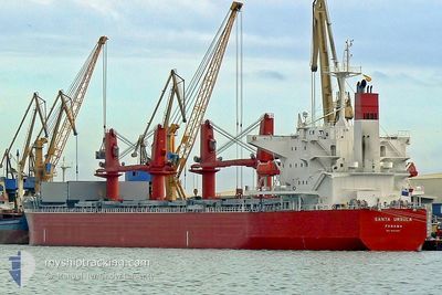
THOR MONADIC
Bulk Carrier
Current Trip
TRIDM
| Time Travelled | --- |
|---|---|
| Remaining Time | --- |
| Distance Travelled | 8484.76 nm |
| Remaining Distance | --- |
| AVG Speed | 9.8 Knots |
| MAX Speed | 9.8 Knots |
| AVG Wind | 10.3 knots |
| MAX Wind | 23.8 knots |
| MIN Temp | 16°C / 60.8°F |
| MAX Temp | 30.9°C / 87.62°F |
| Draught | 6.2 m |
| Position Received | 24 m ago |
Current Position
| Longitude | 36.14185° |
|---|---|
| Latitude | 36.71502° |
| Status | At anchor |
| Speed | |
| Course | 159° |
| Area | Mediterranean Sea - Eastern Basin |
| Station | T-AIS |
| Position Received | 24 m ago |
Info
Information
The current position of THOR MONADIC is in Mediterranean Sea - Eastern Basin with coordinates 36.71502° / 36.14185° as reported on 2024-06-20 03:12 by AIS to our vessel tracker app. The vessel's current speed is 0 Knots
The vessel THOR MONADIC (IMO: 9331220, MMSI: 564411000) is a Bulk Carrier that was built in 2006 ( 18 years old ). It's sailing under the flag of [SG] Singapore.
In this page you can find informations about the vessels current position, last detected port calls, and current voyage information. If the vessels is not in coverage by AIS you will find the latest position.
The current position of THOR MONADIC is detected by our AIS receivers and we are not responsible for the reliability of the data. The last position was recorded while the vessel was in Coverage by the Ais receivers of our vessel tracking app.
The current draught of THOR MONADIC as reported by AIS is 6.2 meters
Weather
| Temperature | 23.1°C / 73.58°F |
|---|---|
| Wind Speed | 3 knots |
| Direction | 335° NNW |
| Pressure | 1008.9 hPa |
| Humidity | 79.8 % |
| Cloud Coverage | 5 % |
Featured Company
Last Port Calls
| Port | Arrival | Departure | Time In Port |
|---|---|---|---|
| 2024-06-02 08:51 | 2024-06-07 17:46 | 5 d | |
| 2024-04-05 18:48 | 2024-04-11 03:29 | 5 d | |
| 2024-04-04 09:46 |
Most Visited Ports (Last year)
| Port | Arrivals | |
|---|---|---|
| 2 | ||
| 1 | ||
| 1 | ||
| 1 | ||
| 1 | ||
| 1 |
Last Trips
| Origin | Departure | Destination | Arrival | Distance | |
|---|---|---|---|---|---|
| 2024-04-11 08:59 | 2024-06-02 10:51 | 7392.58 nm | |||
| 2024-04-04 15:16 | 2024-04-06 00:18 | 84.45 nm |
Events
| Time | Event | Details | Position / Dest | Info |
|---|---|---|---|---|
| 2024-06-20 03:15 | Status Changed | Default At anchor |
36.71501 / 36.14182
TRIDM
|
Speed: Course: 159° |
| 2024-06-20 03:12 | Status Changed | At anchor Default |
36.71502 / 36.14185
TRIDM
|
Speed: Course: 161° |
| 2024-06-20 03:00 | Status Changed | Default At anchor |
36.71498 / 36.14191
TRIDM
|
Speed: Course: 161° |
| 2024-06-20 02:57 | Status Changed | At anchor Default |
36.71496 / 36.14197
TRIDM
|
Speed: 0.1 kn Course: 165° |
| 2024-06-20 02:42 | Status Changed | Default At anchor |
36.71507 / 36.14214
TRIDM
|
Speed: Course: 171° |
| 2024-06-20 02:36 | Status Changed | At anchor Default |
36.71505 / 36.14223
TRIDM
|
Speed: Course: 171° |
| 2024-06-20 02:30 | Status Changed | Default At anchor |
36.71508 / 36.14227
TRIDM
|
Speed: Course: 172° |
| 2024-06-20 01:25 | Status Changed | At anchor Default |
36.71390 / 36.14440
TRIDM
|
Speed: 0.2 kn Course: 270° |
| 2024-06-20 01:12 | Status Changed | Default At anchor |
36.71337 / 36.14434
TRIDM
|
Speed: 0.2 kn Course: 290° |
| 2024-06-20 01:06 | Status Changed | At anchor Default |
36.71310 / 36.14423
TRIDM
|
Speed: 0.1 kn Course: 299° |